Google maps is the most wonderfull aid to getting around while on travel.
Not only does it help to navagate, it can help you plan your travel.
Google Maps can be a valuable tool for water taxi travel, especially in coastal cities and waterfront destinations where routes may not be as clearly marked as roads or rail lines. By selecting the transit option, travelers can often see ferry or water taxi routes, departure points, travel times, and connections to buses or trains. The map view helps identify docks, piers, and nearby landmarks, while real-time updates (where available) provide schedule information and potential delays due to weather or tides. For visitors exploring harbor cities or island communities, Google Maps makes it easier to coordinate waterfront transportation with the rest of the day’s itinerary, ensuring smooth transfers and efficient travel.
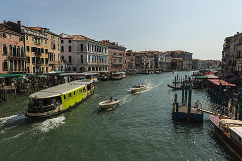
Water taxi travel is a common and essential method of transportation in Venice, Italy, because the city is built on a network of canals instead of roads. With no cars allowed in the historic center, residents and visitors rely on boats for daily movement, whether commuting to work, reaching hotels, or visiting major landmarks. Public water buses known as “vaporetti” operate along the Grand Canal and outer islands, while private water taxis provide faster, more direct service. These boats function much like taxis in other cities, navigating narrow waterways and docking at floating platforms throughout the city. In Venice, traveling by water is not just a novelty for tourists—it is a practical, everyday transportation system woven into the fabric of city life.