Join me as we hike the top
Urban Trails of California
California’s combination of mild climate, coastal geography, and expansive public lands allows true hiking experiences to exist within major cities. Many of these trails offer wildlife sightings, cultural landmarks, and elevation gain comparable to remote hikes—without the long drive or permits
Runyon Canyon Park (Los Angeles)
Hiking the Runyon Canyon Park is one of the most iconic urban hiking experiences in Los Angeles, blending fitness, scenery, and city culture into a single outing. Located just above Hollywood, the park’s trail system climbs the Santa Monica Mountains and offers immediate elevation gain with sweeping views of the city basin. From many vantage points, hikers can see downtown Los Angeles, the Pacific Ocean on clear days, and the nearby Hollywood Hills, making it a visually rewarding hike from start to finish.
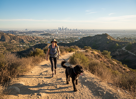
The trails at Runyon Canyon range from moderately steep fire roads to more challenging dirt paths, allowing hikers to choose routes that match their fitness level. Popular options like the Main Trail provide a steady climb with wide-open views, while steeper alternatives offer a more intense workout. The terrain is mostly exposed, so sun protection and water are essential, especially during warmer months. Because of its accessibility and central location, the trail is frequently busy, creating a social atmosphere where locals, tourists, and fitness enthusiasts share the path.
One of Runyon Canyon’s defining characteristics is its energetic, distinctly Los Angeles vibe. It’s common to see dogs (the park is famously dog-friendly), yoga groups, trail runners, and the occasional celebrity enjoying the climb. Early mornings and late afternoons are especially popular, with sunrise and sunset hikes offering dramatic light over the city skyline. Despite its urban surroundings and crowds, Runyon Canyon delivers a genuine hiking experience with elevation, panoramic views, and a strong sense of place—making it a must-do trail for anyone exploring outdoor life in Los Angeles.
Griffith Park Trails (Los Angeles)
Hiking the Griffith Park Trails offers one of the most diverse and scenic urban hiking experiences in Los Angeles. Spanning thousands of acres in the eastern Santa Monica Mountains, Griffith Park feels remarkably wild for a park surrounded by dense urban development. Trails climb from chaparral-covered hillsides to panoramic ridgelines, providing expansive views of downtown Los Angeles, the Hollywood Sign, and the Pacific Ocean on clear days.
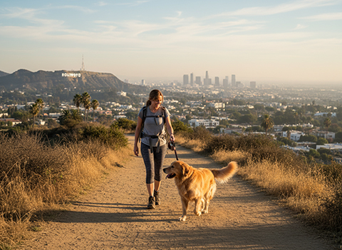
The park’s extensive trail network accommodates a wide range of hikers, from casual walkers to those seeking a challenging workout. Popular routes lead to landmarks such as Griffith Observatory, Mount Hollywood, and the Old Zoo ruins, combining elevation gain with cultural and historical interest. Many trails are wide fire roads with steady climbs, while narrower dirt paths offer steeper ascents and a more rugged feel. Because of the open terrain, hikers should be prepared for sun exposure and carry sufficient water, especially during warmer months.
One of the most appealing aspects of hiking in Griffith Park is how quickly the city seems to fall away as elevation increases. Despite its popularity, the park’s size allows hikers to find quieter routes where birdsong and wind replace traffic noise. Wildlife such as coyotes, hawks, and lizards are commonly seen, reinforcing the sense of nature thriving alongside the city. Whether hiking for fitness, sightseeing, or a peaceful escape, the Griffith Park Trails showcase why Los Angeles is one of the best cities in the country for urban hiking.
Cowles Mountain (San Diego)
Hiking the Cowles Mountain is a classic urban adventure in San Diego, offering big views from the highest point within the city limits. Located in Mission Trails Regional Park, the trail rises prominently above surrounding neighborhoods and provides a sense of wilderness surprisingly close to town. From the outset, hikers are treated to expansive vistas that grow more impressive with every step upward, making the climb as visually rewarding as it is physical.
The Cowles Mountain Trail is relatively short but steep, gaining roughly 950 feet in about 1.5 miles round trip, depending on the route taken. A well-defined dirt path climbs steadily through chaparral and rocky terrain, with little shade along the way. Because of the exposure, hikers are encouraged to bring plenty of water and start early, especially during warmer months. The trail’s popularity makes it busy year-round, but the wide path helps accommodate the steady flow of hikers heading both up and down.
Reaching the summit of Cowles Mountain is a highlight, with sweeping 360-degree views that can include downtown San Diego, the Pacific Ocean, inland valleys, and distant mountains on clear days. Benches at the top provide a place to rest and take in the scenery, often alongside a diverse mix of locals, visitors, and fitness enthusiasts celebrating the climb. Sunrise hikes are particularly popular, offering cooler temperatures and dramatic lighting. For those seeking a challenging yet accessible urban hike, Cowles Mountain delivers a memorable summit experience right in the heart of San Diego.
Lands End Trail (San Francisco)
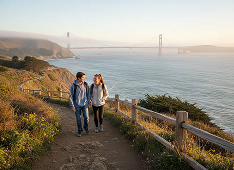
Hiking the Lands End Trail is one of the most scenic urban hikes in San Francisco, offering dramatic coastal views just minutes from dense neighborhoods. Located at the city’s northwestern edge, the trail traces rugged cliffs above the Pacific Ocean, with constant vistas of crashing waves, rocky shoreline, and the iconic Golden Gate Bridge. Despite being within city limits, the setting feels wild and windswept, especially when fog rolls in from the ocean.
The trail is moderately easy, following a well-maintained dirt and gravel path with gentle elevation changes. Several spur trails lead to overlooks, small beaches, and historic features, including remnants of shipwrecks and old military structures. One of the most popular side destinations is the ruins of the Sutro Baths, where hikers can explore tide pools and concrete foundations that hint at the area’s past as a grand seaside resort. Benches and viewpoints along the route make it easy to pause and enjoy the scenery.
Lands End is especially appealing because it combines natural beauty with history and accessibility. Coastal plants, cypress trees, seabirds, and occasional seals or sea lions add to the experience, while cool ocean breezes keep temperatures comfortable year-round. The trail can be busy on weekends, but early mornings and weekdays offer a quieter, more contemplative hike. Whether you’re seeking dramatic views, a relaxing coastal walk, or a taste of San Francisco’s maritime heritage, the Lands End Trail delivers an unforgettable urban hiking experience.
Twin Peaks Trail (San Francisco)
Hiking the Twin Peaks Trail offers one of the most dramatic viewpoints in San Francisco, rising from the city’s center to twin summits that stand more than 900 feet above sea level. Despite its urban surroundings, the trail feels surprisingly open and wild, with expansive views unfolding almost immediately. From the upper slopes, hikers can look out over downtown, the Bay Bridge, the Golden Gate Bridge, and—on clear days—the Farallon Islands far offshore.
The hike itself is relatively short but steadily uphill, making it accessible while still providing a satisfying workout. Paved paths and gravel trails lead from nearby neighborhoods up toward the summits, with a mix of stair sections and gentle switchbacks. The exposed terrain means hikers are often treated to strong winds and quickly changing weather, especially when San Francisco’s famous fog rolls in. Because of this, layers are essential even on sunny days, as conditions can shift rapidly near the top.
Reaching the summit of Twin Peaks is a quintessential San Francisco moment, where the city’s full geography is laid out in every direction. The area is popular for sunrise and sunset hikes, when light and fog combine to create constantly changing views of the skyline and bay. Native grasses and coastal scrub line the trail, and birds of prey are often seen riding the updrafts. For those seeking a short, high-impact urban hike with unbeatable panoramic views, the Twin Peaks Trail delivers an unforgettable perspective on San Francisco.
Mount Tamalpais State Park (Marin County)
Hiking Mount Tamalpais State Park is a quintessential Northern California experience, offering remarkable scenery just north of San Francisco. Known locally as “Mount Tam,” the park rises above Marin County with rolling ridgelines, deep redwood groves, and sweeping coastal views. Despite its proximity to the Bay Area’s urban core, the landscape feels expansive and wild, with constant visual contrast between forested slopes, open grasslands, and the Pacific Ocean.

The park features an extensive network of trails suited to hikers of all abilities, from gentle redwood walks to challenging summit routes. Popular hikes such as the Matt Davis Trail, Dipsea Trail segments, and Old Railroad Grade offer varied terrain and elevation gain, often linking shaded forest paths with exposed ridges. As hikers climb higher, views open to San Francisco Bay, the Farallon Islands, and on clear days, even the Sierra Nevada in the distance. The diversity of ecosystems encountered on a single hike is one of Mount Tamalpais’s defining qualities.
Reaching the upper slopes or summit area is especially rewarding, with panoramic vistas that make Mount Tam one of the most scenic overlooks in the region. Coastal fog frequently spills over the ridges, creating dramatic shifts in light and atmosphere throughout the day. Wildlife such as deer, coyotes, and a wide range of bird species are commonly seen along the trails. Whether approached as a casual nature walk or a long-distance hike linking multiple trails, Mount Tamalpais State Park delivers a deeply immersive outdoor experience that feels far removed from the nearby city.
Bidwell Park Trails (Chico)
Hiking the Bidwell Park Trails offers an exceptional urban-nature experience in Chico, where one of the largest municipal parks in the United States stretches directly from the edge of downtown into rugged foothills. The park follows Big Chico Creek for miles, transitioning from manicured green spaces in Lower Bidwell Park to dramatic volcanic landscapes in Upper Bidwell Park. This gradual shift gives hikers the feeling of moving from city parkland into true wilderness without ever leaving town.
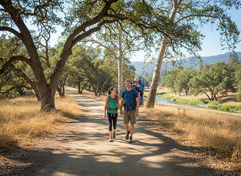
The trail network is extensive and varied, accommodating everything from casual strolls to longer, more adventurous hikes. Lower Bidwell Park features flat, shaded paths near the creek, popular for relaxed walks and wildlife viewing, while Upper Bidwell Park introduces rocky singletrack, basalt cliffs, and rolling hills that provide more elevation gain and sweeping views. Landmarks such as Monkey Face rock formation, Horseshoe Lake, and seasonal waterfalls add visual interest and make each hike feel distinctive. The Mediterranean climate means hiking is possible year-round, though spring wildflowers and flowing water are especially appealing.
One of Bidwell Park’s standout qualities is its blend of accessibility and raw natural beauty. Deer, birds, and other wildlife are commonly seen, and swimming holes along Big Chico Creek offer refreshing breaks during warmer months. As elevation increases, city sounds fade and expansive views over Chico and the Sacramento Valley emerge. Whether used for a short urban escape or a longer exploratory hike into the foothills, the Bidwell Park Trails provide a rare opportunity to experience diverse Northern California landscapes directly from the heart of the city.
American River Parkway (Sacramento)
Hiking the American River Parkway offers a rare opportunity to experience a long, continuous natural corridor running directly through Sacramento. Stretching more than 30 miles along the American River, the parkway connects a series of parks, riparian forests, and open riverbanks that feel far removed from surrounding neighborhoods. Towering cottonwoods, oak woodlands, and wide river views create a calm, scenic atmosphere that makes the parkway one of the most popular outdoor escapes in the region.
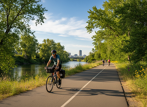
The trail system is mostly flat and well maintained, making it ideal for hikers of all skill levels. Paved multi-use paths parallel the river, while dirt side trails lead closer to the water and into quieter natural areas. Because of its length, hikers can easily tailor outings ranging from short neighborhood walks to longer point-to-point hikes linking areas such as Old Sacramento, Discovery Park, and the eastern stretches near Folsom. Seasonal changes bring different highlights, from spring wildflowers to golden fall foliage reflecting off the river.
Wildlife is one of the American River Parkway’s greatest attractions, especially given its urban setting. Deer are commonly seen grazing near the trail, and birds such as herons, egrets, hawks, and songbirds are abundant year-round. The river itself adds constant visual interest, with kayakers, anglers, and shifting currents enhancing the sense of movement and life. Whether used for daily walks, long-distance hikes, or quiet moments by the water, the American River Parkway delivers a uniquely accessible and immersive nature experience in the heart of Sacramento.
Mount Rubidoux (Riverside)
Hiking Mount Rubidoux is a classic urban hike in Riverside, offering sweeping views with minimal distance from downtown neighborhoods. Rising prominently above the Santa Ana River, Mount Rubidoux is a historic city landmark that blends outdoor recreation with local heritage. The trailhead sits near residential streets and parkland, and within minutes of starting the climb, hikers are rewarded with expanding vistas over Riverside and the broader Inland Empire.
The hike itself is short but steadily uphill, following a paved road that winds to the summit. This makes the route accessible to a wide range of hikers, including families and casual walkers, while still providing a satisfying workout. Benches and viewpoints are spaced along the way, encouraging pauses to enjoy the scenery or catch a breeze. Because of the open terrain, the trail can be warm during the day, so early mornings and late afternoons are popular, especially during warmer seasons.
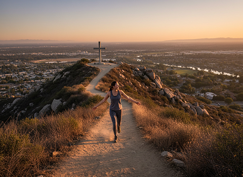
At the summit, hikers find panoramic views stretching across Riverside, surrounding valleys, and distant mountain ranges on clear days. A large cross and historic markers highlight Mount Rubidoux’s cultural significance, particularly during holiday and sunrise hikes that draw large crowds. Birds, city lights at dusk, and changing skies add to the experience, making each visit feel a little different. Whether approached as a quick fitness hike, a scenic stroll, or a sunrise tradition, Mount Rubidoux delivers a memorable and accessible hiking experience at the heart of the city.
Mission Peak (Bay Area)
Hiking Mission Peak is one of the most popular and challenging urban hikes in the Bay Area, drawing hikers from across the region to its iconic summit. Located in the hills above Fremont, the peak rises prominently over Silicon Valley and the East Bay, offering expansive views that stretch from San Francisco Bay to the Diablo Range. Despite being surrounded by dense suburban development, the open grasslands and wide skies give the hike a surprisingly remote feel.
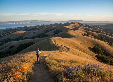
The trail to Mission Peak is steep and physically demanding, with routes such as the Mission Peak Trail and Ohlone College Trail gaining significant elevation over a relatively short distance. Long, exposed sections mean hikers are often climbing under full sun, making water, sun protection, and good pacing essential. The terrain is mostly dirt and gravel, with switchbacks that help manage the climb but still deliver a serious workout. Because of its popularity, the trail is often busy, especially on weekends, creating a lively and social hiking atmosphere.
Reaching the summit is a defining moment, marked by the famous summit pole that hikers often line up to touch or photograph. From the top, sweeping 360-degree views reveal the entire South Bay, Mount Diablo, and—on especially clear days—the Sierra Nevada far in the distance. Wind is common at the peak, adding both relief on warm days and a reminder to bring layers. Whether tackled for fitness, the views, or the sense of accomplishment, Mission Peak delivers a high-reward urban hike that has become a rite of passage for many Bay Area hikers.