Join me as we hike the top
Urban Trails of Arizona
Arizona’s urban hiking is defined by desert beauty, red rock scenery, and rocky ridgelines rising directly from city limits. Phoenix’s Camelback Mountain and Tucson’s foothill trails offer steep climbs and panoramic sunsets, while Sedona’s urban-edge hikes feel otherworldly. Dry air and open terrain make visibility incredible year-round.
Camelback Mountain – Phoenix
Camelback Mountain is one of the most iconic and challenging urban hikes in Arizona, rising dramatically above the neighborhoods of central Phoenix. The Echo Canyon Trail is the most popular route to the summit and is famous for its steep climbs, rocky stair-step sections, and intense elevation gain packed into a relatively short distance. From the very beginning, hikers are treated to classic Sonoran Desert scenery—saguaro cacti, desert wildflowers in spring, and sweeping views of the city creeping closer behind you as you climb.
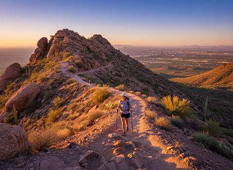
The trail itself is demanding and often requires using hands as well as feet, especially in the upper half where the route becomes more of a scramble over boulders and steep rock faces. Chains, railings, and markers help guide hikers through the toughest sections, but the hike still requires good footwear, plenty of water, and careful pacing. Because of its popularity, Echo Canyon can be crowded, especially early in the morning, with everyone from dedicated athletes to tourists attempting the climb.
Reaching the summit is an unforgettable payoff, with panoramic views stretching across the entire Phoenix metro area and out toward distant desert mountain ranges. Sunrise is especially spectacular from the top, as the city lights fade and the desert landscape glows orange and gold. Despite being in the middle of a major city, Camelback offers a true Arizona mountain challenge, making it one of the most famous urban hikes in the entire Southwest.
Piestewa Peak – Phoenix
Piestewa Peak is one of Phoenix’s most beloved urban hiking destinations, offering a steep but approachable climb with rewarding views. Located in the Phoenix Mountains Preserve, the Summit Trail is a local favorite for fitness hiking because it delivers a serious workout without requiring a long drive into remote wilderness. The trail winds upward through rocky desert terrain filled with saguaros, cholla cactus, palo verde trees, and wide-open city vistas.
The climb is steady and fairly intense, with many switchbacks and rock steps that grow more challenging near the top. Along the route, hikers often pause at scenic overlooks to catch their breath and take in the expanding views across Phoenix and toward Camelback Mountain in the distance. The trail is well-maintained and heavily used, making it a great option for those who want a mountain hike experience while still staying close to urban amenities.
At the summit, hikers are rewarded with one of the best panoramic viewpoints in the city. On clear days, you can see downtown Phoenix, the surrounding desert preserves, and distant mountain ridges stretching toward the horizon. Piestewa Peak is especially popular in the early morning and evening hours, when temperatures are cooler and the desert light is at its most beautiful. It’s a classic Phoenix hike that perfectly captures the blend of rugged nature and city accessibility.
South Mountain National Trail – Phoenix
South Mountain Park is one of the greatest urban outdoor treasures in Arizona, covering thousands of acres right at the edge of the Phoenix metro area. The National Trail is one of its most popular and scenic routes, taking hikers deep into rugged Sonoran Desert terrain while still remaining within city limits. From the start, the trail offers a feeling of wide-open wilderness, with rocky ridgelines, desert valleys, and towering saguaros surrounding the path.
The National Trail is known for its variety, with rolling stretches of hiking mixed with steeper climbs and rocky segments that require careful footing. As you progress, the landscape becomes increasingly dramatic, with expansive viewpoints opening up across Phoenix and beyond. Because the trail traverses the spine of South Mountain, hikers can experience changing perspectives throughout the route—sometimes looking toward the city skyline, and other times gazing into vast desert country that seems far removed from urban life.
One of the highlights of hiking here is the sense of scale: South Mountain Park is so large that you can hike for hours and still feel immersed in nature. At higher points along the trail, sunsets can be spectacular, with the city lights beginning to sparkle below while the sky turns brilliant shades of orange and purple. The National Trail is a perfect example of how Phoenix offers true desert mountain hiking experiences right inside the boundaries of a major city.
Papago Park (Hole-in-the-Rock) – Phoenix/Tempe
Papago Park is one of the most accessible and family-friendly urban hiking areas in the Phoenix region, known for its distinctive red sandstone formations and easy desert trails. Located between Phoenix and Tempe, the park offers a network of short paths that weave through scenic desert terrain without demanding steep climbs or strenuous effort. The landscape here feels uniquely Southwestern, with wide open spaces, saguaros, and unusual rock shapes that make the hikes especially enjoyable for casual explorers.
The most famous destination in Papago Park is Hole-in-the-Rock, a natural rock formation with openings that hikers can climb into for a perfect viewpoint. The hike is short and manageable, but the payoff is excellent, giving visitors a panoramic look over the surrounding city, nearby buttes, and desert greenery. Because the trail is so easy to reach, it is popular with photographers, families, and travelers looking for a quick outdoor stop.
Papago Park is especially magical during sunrise and sunset, when the red rocks glow warmly in the changing light. Its proximity to major attractions like the Desert Botanical Garden and the Phoenix Zoo also makes it a central outdoor destination for both locals and tourists. While it may not be the most difficult hike on this list, Papago Park delivers classic Arizona desert scenery in one of the most convenient urban settings imaginable.
Pinnacle Peak Trail – Scottsdale
Pinnacle Peak Trail is one of the most popular and approachable urban hikes in the Scottsdale area, offering a beautiful introduction to the Sonoran Desert without requiring a strenuous climb. Located in Pinnacle Peak Park, this well-maintained trail winds through classic desert scenery filled with towering saguaros, prickly pear cactus, and palo verde trees. The surrounding granite hills and wide-open desert sky create a peaceful setting that feels removed from the nearby city streets.

The hike itself is a moderate out-and-back route with a gently rolling elevation gain rather than steep scrambling. This makes it especially popular with hikers of all experience levels, including families, casual walkers, and visitors looking for a scenic desert experience. Along the path, interpretive signs highlight the unique plants, wildlife, and ecology of the region, adding an educational aspect to the walk. Because the footing is generally smooth, it’s also a great option for those who want a less technical trail.
One of the best parts of Pinnacle Peak Trail is the panoramic scenery throughout the hike. Even without reaching a true summit, hikers enjoy sweeping views of Scottsdale, distant mountain ranges, and endless desert stretching toward the horizon. In the early morning or late afternoon, the golden desert light makes the landscape especially striking. Pinnacle Peak is a perfect urban hike for those seeking a relaxing but authentic Arizona desert outing close to town.
Tom’s Thumb Trail – Scottsdale
Tom’s Thumb Trail is one of the most dramatic and rewarding urban hikes in the Scottsdale area, located within the vast McDowell Sonoran Preserve. This trail is known for its rugged scenery, steady climb, and the impressive granite rock formations that dominate the landscape. The hike leads toward Tom’s Thumb, a distinctive rock spire perched high in the McDowell Mountains, making it one of the most recognizable landmarks in the preserve.
The trail begins in classic Sonoran Desert terrain, passing through forests of saguaro cactus and rocky desert washes before gradually climbing upward. As elevation increases, the views expand, revealing Scottsdale far below and the surrounding desert mountain ranges in every direction. The hike is more challenging than Pinnacle Peak, with a sustained uphill grade and some rocky sections, but it remains non-technical and manageable with good pacing and preparation.
The payoff comes near the upper portion of the trail, where massive granite boulders and cliff-like formations create an almost otherworldly landscape. Standing near Tom’s Thumb itself feels like reaching a desert cathedral of stone, with breathtaking overlooks that make the climb worthwhile. Sunrise hikes here are especially memorable, as the first light ignites the granite peaks and casts long shadows across the desert floor. Tom’s Thumb Trail is a standout urban hike that combines accessibility with true mountain-desert adventure.
Sabino Canyon – Tucson
Sabino Canyon is one of the most beloved hiking and outdoor recreation areas in Tucson, offering an incredible blend of desert scenery, canyon landscapes, and mountain backdrops all within easy reach of the city. Located in the Santa Catalina foothills, Sabino Canyon feels like a natural oasis, with towering saguaros, mesquite trees, and rugged cliffs rising above the winding canyon floor. Unlike many desert hikes, this area also features seasonal flowing water, creating a unique and refreshing environment.
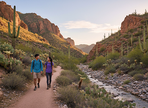
The trail system here is extensive, ranging from paved canyon walks to more rugged backcountry routes leading deeper into the mountains. Many hikers begin along the Sabino Canyon Road, a scenic route that follows the canyon and provides access to waterfalls, side trails, and shaded rest areas. The accessibility of the area—along with the optional tram service—makes Sabino Canyon especially popular with a wide range of visitors, from casual walkers to serious hikers looking for longer adventures.
What makes Sabino Canyon truly special is the combination of urban convenience and striking natural beauty. Hikers can experience desert wildlife, dramatic rock formations, and expansive views of Tucson below, all in a setting that feels far removed from city life. Spring brings vibrant wildflowers, while summer monsoon season can transform the canyon with rushing water and lush greenery. Sabino Canyon is often considered Tucson’s premier urban hiking destination, offering both easy strolls and challenging mountain routes.
Tumamoc Hill – Tucson
Tuma Moc Hill is one of Tucson’s most iconic urban hikes, known primarily as a steep fitness climb with outstanding city views. The trail is a paved road that ascends the hill in a steady, strenuous grade, attracting runners, walkers, and hikers from early morning through the evening. Because it is used heavily for exercise, Tumamoc Hill has a strong local culture—regular hikers often greet each other as they make their way up the climb.
The hike is relatively short, but the elevation gain makes it a serious workout, especially under the Arizona sun. Along the way, hikers enjoy sweeping views over Tucson, the surrounding desert basin, and distant mountain ranges. The higher you climb, the more dramatic the panorama becomes, with the city grid below contrasting sharply against the rugged desert landscape. Because it is paved and clearly defined, Tumamoc Hill is a popular choice for people who want a dependable and accessible workout hike.
At the summit, hikers are rewarded with one of the best urban overlooks in southern Arizona. Sunrise and sunset are especially spectacular here, with golden desert light spreading across Tucson and the mountains beyond. Tumamoc Hill also has cultural and scientific significance, as it is part of a long-standing ecological research area. The trail is both a community gathering place and a true Tucson landmark, offering a simple but unforgettable urban hiking experience.
Sentinel Peak (A-Mountain) – Tucson
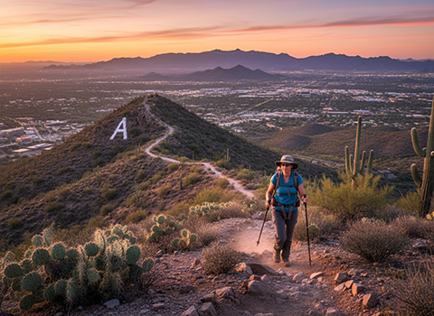
Sentinel Peak, commonly known as “A-Mountain,” is one of Tucson’s most recognizable urban hikes, rising just west of downtown. The trail is short, steep, and highly rewarding, making it a favorite for locals looking for a quick outdoor escape without leaving the heart of the city. The large white “A” on the hillside is a historic landmark tied to the University of Arizona, and hiking here provides a unique blend of natural desert terrain and city culture.
The hike follows a paved road and trail segments that climb rapidly upward, gaining elevation quickly in a short distance. Because it is so accessible, A-Mountain is popular with walkers, runners, students, and visitors seeking panoramic views with minimal time commitment. Along the way, hikers can appreciate the contrast between the rugged desert hillside—covered in cactus and desert shrubs—and the nearby urban streets and neighborhoods below.
At the top, the views are spectacular, offering one of the best overlooks of Tucson’s downtown skyline, the surrounding desert basin, and the distant Santa Catalina, Rincon, and Tucson mountain ranges. Sunset is especially popular here, as the city begins to glow with lights while the sky turns brilliant colors over the desert. Sentinel Peak may be a shorter hike than others on this list, but it delivers an unforgettable urban summit experience and is one of Tucson’s true signature trails.
Cathedral Rock – Sedona
Cathedral Rock Trail is one of the most famous hikes in all of Arizona, and although Sedona is smaller than Phoenix or Tucson, this trail remains an iconic “urban-accessible” hike because of its close proximity to town. The trail climbs into Sedona’s legendary red rock landscapes, where towering sandstone buttes rise dramatically above the desert floor. Even from the trailhead, hikers are surrounded by breathtaking scenery that feels both otherworldly and uniquely Arizonan.
TheThe hike is short but steep, requiring some scrambling as you ascend slickrock sections toward the saddle between the massive rock formations. Each step upward reveals wider views of Sedona’s red rock valleys, desert vegetation, and distant mesas. The combination of vivid stone colors, twisting juniper trees, and expansive horizons makes this one of the most visually stunning hikes in the Southwest. Though it can be crowded, the trail’s beauty and accessibility make it a must-do for visitors.
Reaching the upper saddle area is the highlight, where hikers can sit among the red rocks and take in panoramic views that are truly unforgettable, especially at sunrise or sunset. The golden light reflecting off the crimson cliffs creates a magical atmosphere that has made Cathedral Rock a symbol of Sedona itself. This hike perfectly captures why Arizona’s urban and near-urban trails are so special: world-class landscapes and adventure are often just minutes from town.