Join me as we hike the top
Urban Trails of Arkansas
Urban hiking in Arkansas is rich with forested hills, riverside paths, and rocky bluffs near growing city centers like Little Rock and Fayetteville. Trails along the Arkansas River or in Pinnacle Mountain State Park bring nature into daily city life. The Ozark influence gives many urban hikes a rugged, wooded character.
Pinnacle Mountain Summit Trail – Little Rock
Pinnacle Mountain is the signature urban hike of central Arkansas, rising prominently just west of Little Rock in Pinnacle Mountain State Park. Despite being only a short drive from the city, the mountain feels like a true wilderness landmark, offering rugged terrain, expansive forest scenery, and some of the best panoramic views in the region. Pinnacle Mountain is often considered one of the must-do hikes in Arkansas because it provides both challenge and accessibility close to an urban center.
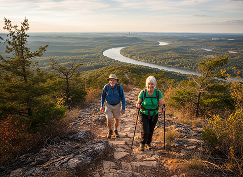
The Summit Trail is steep, rocky, and demanding, especially in the upper sections where hikers scramble over boulders and exposed rock faces. The trail climbs quickly through oak and pine forest before opening into bare stone slopes that require careful footing. Along the way, hikers enjoy increasingly dramatic views of the Arkansas River Valley, with the city of Little Rock visible in the distance and rolling hills stretching toward the horizon.
Reaching the summit is an unforgettable payoff, with a sweeping 360-degree panorama over Lake Maumelle, the Ouachita Mountains, and central Arkansas’s endless green ridges. Sunrise and sunset hikes are especially popular here, as the landscape glows with warm light over the river valley. Pinnacle Mountain perfectly captures the blend of rugged mountain adventure and urban convenience, making it Arkansas’s premier city-adjacent hike.
Arkansas River Trail (Big Dam Bridge) – Little Rock
The Arkansas River Trail is one of the most beloved urban outdoor routes in the state, connecting Little Rock and North Little Rock with scenic riverside walking and hiking paths. A highlight of the system is the Big Dam Bridge, the longest pedestrian and bicycle bridge in North America built specifically for foot and bike traffic. This trail offers an entirely different kind of urban hiking experience—flat, accessible, and focused on river views and city scenery..
The trail system winds along the Arkansas River, passing parks, wetlands, and open green spaces where walkers and cyclists share the path. The Big Dam Bridge itself provides spectacular views up and down the river, with the downtown skyline visible in one direction and forested bluffs and water stretching out in the other. Because the terrain is easy and well-maintained, it’s a perfect choice for families, casual hikers, and anyone seeking a relaxing outdoor walk close to the city.
What makes the River Trail special is its combination of nature and urban energy. You can watch boats on the river, spot birds along the shoreline, and enjoy sunrise reflections on the water—all while remaining right in the heart of Arkansas’s capital region. Evening strolls are especially beautiful when city lights begin to sparkle across the river. The Arkansas River Trail is one of the best examples of an urban hike that blends recreation, scenery, and city accessibility.
Mount Nebo Rim Trail – Dardanelle/Russellville
Mount Nebo State Park is one of Arkansas’s most breathtaking mountain destinations, perched high above the Arkansas River Valley near the towns of Dardanelle and Russellville. The Rim Trail is the park’s signature hike, offering a relatively moderate route that circles along the mountaintop, providing nonstop scenic overlooks. Despite its mountain setting, Mount Nebo is easily accessible by road, making it a near-urban hike for residents of the River Valley region.
The Rim Trail winds through hardwood forests, rocky outcrops, and peaceful shaded sections, with frequent openings where sweeping vistas appear unexpectedly. Hikers can look out across the river valley, farmland, and distant ridges of the Ozark and Ouachita Mountains. The trail is well-maintained and generally not overly strenuous, making it popular with casual hikers as well as photographers seeking some of the best viewpoints in central Arkansas.
Mount Nebo is especially famous for its sunsets, which are considered among the finest in the state. From the rim overlooks, the sky often lights up in brilliant orange and pink hues over the valley below. In autumn, the surrounding forests blaze with color, making the Rim Trail a seasonal favorite. Mount Nebo’s combination of easy access, mountaintop beauty, and constant scenic rewards makes it one of Arkansas’s premier near-urban hiking experiences..
Hot Springs Mountain Trail – Hot Springs National Park
Hot Springs National Park offers one of the most unique urban hiking opportunities in the United States, where forested mountain trails rise directly above the historic spa city of Hot Springs. The Hot Springs Mountain Trail is a popular route that provides hikers with a peaceful woodland climb while remaining just minutes from Bathhouse Row and downtown attractions. It’s a rare chance to hike through protected mountain scenery right alongside an active city environment.
The trail climbs steadily through oak and pine forest, with switchbacks and shaded terrain that feel surprisingly remote despite the nearby streets below. Along the way, hikers can explore the area’s natural thermal spring history, as the park preserves both the geological features that created the hot springs and the cultural heritage of the bathhouse era. The trail is moderate and approachable, making it a favorite for visitors who want both outdoor recreation and historic context.
Reaching higher elevations on Hot Springs Mountain rewards hikers with scenic overlooks and the chance to visit the Hot Springs Mountain Tower, which offers panoramic views across the Ouachita Mountains. The combination of lush forest hiking, historic charm, and city convenience makes this trail a standout urban hike not only in Arkansas, but nationally. Hot Springs Mountain Trail perfectly captures Arkansas’s blend of natural beauty and cultural landscape.
Camel’s Back Trail – Fayetteville
Camel’s Back Trail is one of the most popular urban hikes in Fayetteville, located in the heart of Northwest Arkansas’s scenic Ozark foothills. This trail is beloved for offering a true woodland hiking experience right within the city, climbing through dense forest toward panoramic viewpoints near Mount Sequoyah. Fayetteville is known for its strong outdoor culture, and Camel’s Back is a perfect example of an accessible trail that still delivers rugged Ozark beauty close to town.
The hike is moderate, with steady elevation gain as the trail winds upward through a mix of oak and hickory forest. The path feels peaceful and surprisingly wild for an urban setting, with birdsong, thick undergrowth, and occasional rocky sections that add character. Because it connects into Fayetteville’s broader trail and greenway network, Camel’s Back is popular with hikers, trail runners, and locals seeking a quick escape into nature without leaving the city limits.
At the upper portions of the trail, hikers are rewarded with excellent views over Fayetteville and the rolling hills of the Ozarks beyond. In autumn, the trail becomes especially spectacular, with яр colored foliage transforming the forest into a vivid landscape of red and gold. Camel’s Back Trail captures the spirit of Northwest Arkansas hiking: close-to-town access paired with authentic mountain terrain and memorable scenery.
Lake Catherine Falls Trail – Hot Springs area
Lake Catherine Falls Trail is one of the most beautiful and rewarding near-urban hikes in the Hot Springs region, located within Lake Catherine State Park. This trail is especially famous for its picturesque waterfall, which is one of the most beloved natural features in central Arkansas. Despite being close to Hot Springs and easily accessible, the hike feels like a true forest retreat, with lush greenery, rocky streams, and quiet woodland atmosphere.
The trail winds through hardwood forests and along a scenic creek corridor, with gentle to moderate terrain that makes it approachable for many hikers. Wooden bridges, mossy rocks, and shaded ravines add to the enchanting feel of the hike. As you near the falls, the sound of rushing water grows louder, building anticipation for the dramatic reveal of Lake Catherine Falls cascading over stone ledges.
The waterfall itself is the highlight, especially after rainfall when the flow is strongest and most impressive. Many hikers pause here to take photos, enjoy the cool mist, or simply relax in the peaceful surroundings. In spring and summer, the forest is vibrant and green, while autumn adds colorful foliage to the scene. Lake Catherine Falls Trail is a perfect Arkansas near-urban hike, offering a magical waterfall destination within an easy drive of city comforts.
Lost Valley Trail – Ponca (Buffalo River area)
Lost Valley Trail is one of the most beloved hikes in Arkansas, located near the small town of Ponca in the Buffalo National River region. Although it sits outside a major city, it is often considered a near-urban hike for travelers based in nearby towns and for its popularity as one of the most accessible Ozark classics. The trail delivers an unforgettable combination of towering bluffs, waterfalls, caves, and lush wooded scenery, making it a must-do Arkansas hike.
The hike begins along a gentle forest path following a clear stream through a narrow valley framed by dramatic limestone cliffs. The trail is relatively easy at first, making it approachable for families and casual hikers, but it gradually leads deeper into a landscape that feels almost magical. Along the way, hikers pass small cascades, moss-covered boulders, and rich Ozark vegetation, with the sound of running water creating a peaceful atmosphere throughout the valley.
Perseverance Trail is especially popular in summer, when wildflowers bloom and the creek runs high with snowmelt from the surrounding mountains. The shaded canyon keeps temperatures cooler than in town, making it a comfortable option on warmer days. Wildlife sightings are possible, and the sound of rushing water accompanies much of the hike, adding to its immersive feel. Combining natural beauty, accessible terrain, and a strong sense of place, the Perseverance Trail is one of Juneau’s most rewarding and informative hikes close to the city.
Northwoods Trail – Hot Springs
Hiking the Kaxdigoowu Heen Dei (Mendenhall River Trail) near Juneau is a gentle and scenic way to experience Southeast Alaska’s temperate rainforest and riverside environment without a strenuous climb. This accessible trail—whose Tlingit name means “going back clearwater trail”—begins near the Brotherhood Bridge off Glacier Highway and follows the riparian corridor of the Mendenhall River, offering peaceful views of flowing water, forest canopy, and distant peaks. The paved pathway is smooth and easy to navigate, making it suitable for hikers of all ages and abilities, as well as cyclists and joggers.
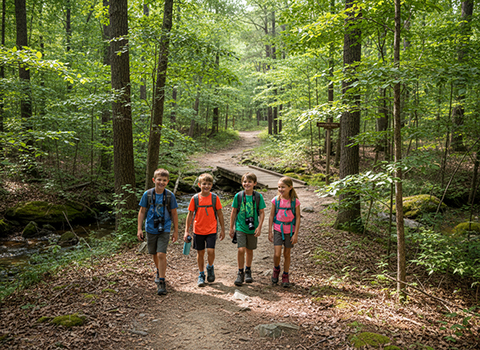
The route is typically about 2 miles one way (roughly 4 miles round trip), with very mild elevation gain, ensuring a relaxed pace and plenty of opportunities to pause and soak in the surroundings. Lush spruce and other temperate rainforest species flank the trail, and open sections often reveal fireweed and other wildflowers in summer. On clear days, distant views of Mendenhall Glacier and the surrounding mountains can be glimpsed beyond the river corridor—an added visual reward for this otherwise low-effort hike.
The highlight of Lost Valley Trail is the waterfall and cave area near the end, where hikers can explore behind a cascading falls and even venture into a large natural cave shelter. This destination feels like stepping into an Ozark hidden world, especially in spring when water flow is strongest. Lost Valley is one of Arkansas’s most iconic trails because it offers so much natural wonder in a relatively short and accessible hike.
Whitaker Point (Hawksbill Crag) Trail – Ozarks
Whitaker Point, more famously known as Hawksbill Crag, is one of the most iconic hiking destinations in all of Arkansas. Located in the Ozark National Forest, this trail is often considered a near-urban classic because of its popularity and accessibility for travelers staying in nearby towns such as Jasper or the Northwest Arkansas corridor. Hawksbill Crag is legendary for its dramatic rock outcrop that juts out over the forest, creating one of the most photographed views in the state.
The hike itself is moderate, winding through peaceful Ozark woods filled with oak, pine, and dense undergrowth. The trail is well-established, with rolling terrain that includes gentle climbs and a few rocky sections. As you approach the end, anticipation builds as the forest begins to open toward the cliffs and expansive views beyond. The hike feels like a journey into the heart of the Ozarks, offering quiet solitude despite its fame.
Reaching the crag is an unforgettable moment, with sweeping vistas of endless forested hills stretching across the horizon. The rocky ledge provides a breathtaking overlook, especially at sunrise when mist often fills the valleys below. Autumn is particularly spectacular, as the Ozark canopy turns brilliant shades of red, orange, and gold. Whitaker Point is one of Arkansas’s crown jewel hikes, offering an epic natural viewpoint within reach of urban travelers and outdoor enthusiasts.
Two Rivers Park Trail – Little Rock
Two Rivers Park Trail is one of Little Rock’s most relaxing and scenic urban hiking routes, located at the confluence of the Arkansas River and the Little Maumelle River. This trail is part of the city’s extensive greenway system, providing an accessible outdoor escape that blends riverside nature with the convenience of being right within the capital region. It’s especially popular with walkers, runners, cyclists, and families seeking an easy but beautiful urban hike.
The trail winds through open riverfront landscapes, shaded wooded patches, and peaceful wetlands where wildlife is often visible. Because the terrain is mostly flat and smooth, it’s a perfect choice for casual hikes, long strolls, or outdoor exercise. Along the way, hikers can enjoy wide views of the rivers, seasonal wildflowers, and the calming presence of water flowing beside the path.
What makes Two Rivers Park especially special is its sense of openness and tranquility despite being so close to the city. Sunrise walks here are stunning, with golden light reflecting across the river, while evening outings offer cool breezes and quiet scenic beauty. Two Rivers Park Trail represents the best side of urban hiking in Arkansas: easy access, river landscapes, and a peaceful natural retreat woven into the city itself.