The Hiking Man Hikes Virginia

The Urban Trail Hiker
Hiking in Virginia offers a rich blend of Appalachian beauty, historic trails, and diverse natural landscapes. The state is home to over 500 miles of the Appalachian Trail, including iconic sections like McAfee Knob, Dragon’s Tooth, and Tinker Cliffs, all offering breathtaking views of the Blue Ridge Mountains. In Shenandoah National Park, the Old Rag Mountain and Whiteoak Canyon trails provide challenging climbs, waterfalls, and sweeping vistas. Beyond the mountains, Virginia’s coastal regions and piedmont offer gentle woodland hikes, wetlands, and scenic rivers. With its four-season beauty and well-maintained trail systems, Virginia is a favorite for both casual walkers and serious backpackers seeking adventure and tranquility in the great outdoors.

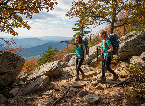
Old Rag Mountain Loop (Shenandoah National Park)

Hiking the Old Rag Mountain Loop is widely considered one of the most iconic and challenging day hikes in Virginia, offering a rugged adventure that feels more alpine than most East Coast trails. The loop begins with a steady ascent through forested terrain, often along the Ridge Trail, where switchbacks gradually give way to rocky outcrops and widening views. As elevation increases, hikers are rewarded with glimpses of the Shenandoah Valley and the rolling Piedmont to the east, setting the stage for the dramatic terrain ahead.
Old Rag Mountain Loop

The defining feature of the Old Rag Mountain Loop is its famous rock scramble, a lengthy section where hikers must climb, squeeze, and maneuver through massive granite boulders. This portion transforms the hike from a simple walk into a hands-on adventure, requiring balance, patience, and occasional problem-solving. While the scramble is physically demanding and not ideal for those with a fear of tight spaces or heights, it is also the most memorable part of the experience, offering a sense of accomplishment and playful exploration rarely found on other regional trails.

Reaching the summit of Old Rag Mountain is a highlight, with expansive 360-degree views that stretch across Shenandoah National Park, the Blue Ridge Mountains, and beyond on clear days. After soaking in the scenery, hikers descend via the Saddle Trail and fire road, which provide a gentler but still lengthy return to the trailhead. Due to its popularity, exposure, and difficulty, Old Rag requires preparation—ample water, sturdy footwear, and an early start—but for those ready to take it on, the loop delivers one of the most rewarding hiking experiences in the Mid-Atlantic.

McAfee Knob (Appalachian Trail near Roanoke)

Hiking McAfee Knob is one of the most iconic experiences on the Appalachian Trail, drawing hikers from across the country to its dramatic cliffside overlook near Roanoke. The trail begins with a steady climb through hardwood forest, gradually gaining elevation as it winds uphill. Along the way, the terrain alternates between dirt path, rock steps, and exposed sections, offering a satisfying sense of progression as the forest thins and views begin to open.
McAfee Knob Appalachian Trail

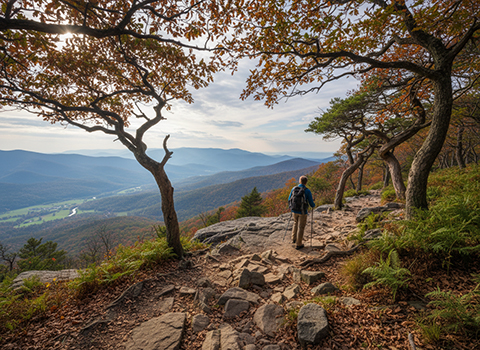
The approach to McAfee Knob builds anticipation, culminating in the famous rock ledge that juts out over the valley below. This natural balcony provides sweeping views of the Catawba Valley, North Mountain, and surrounding ridgelines of western Virginia. The ledge itself is large enough to safely sit and rest, but its sheer drop creates a thrilling sense of exposure that makes the viewpoint unforgettable. It is also one of the most photographed spots on the entire Appalachian Trail, especially during sunrise and sunset when light spills across the landscape.

After taking in the views, hikers typically return the same way, retracing their steps through quiet forest and ridgeline terrain. The hike is moderately strenuous, with consistent elevation gain and limited water sources, so preparation is important—sturdy footwear, sufficient water, and awareness of weather conditions are key. Whether tackled as a rewarding day hike or visited as part of a longer Appalachian Trail journey, McAfee Knob offers a perfect blend of physical challenge, natural beauty, and classic Blue Ridge scenery.

Dragon’s Tooth (Catawba)

Hiking Dragon’s Tooth is one of the most rugged and adventurous experiences along this section of the Appalachian Trail. The trail climbs steadily through mixed hardwood forest, gaining elevation as it follows rocky terrain and narrow ridgelines. From the outset, hikers can tell this is not a casual walk—uneven footing, exposed roots, and increasing rockiness demand attention and deliberate movement as the mountain rises above the Catawba Valley.
Dragon’s Tooth

As the summit approaches, the hike turns into a true scramble, with ladders, metal rungs, and steep rock faces assisting hikers through tight gaps and near-vertical sections. These final stretches are the defining feature of Dragon’s Tooth, requiring hands-on climbing and a head for heights. The challenge is part of the appeal, offering a sense of technical adventure that stands out even among Virginia’s more demanding hikes. While the exposure can be intimidating, the route is well-marked and carefully aided, making it accessible to prepared hikers with good balance and patience.

At the top, Dragon’s Tooth delivers dramatic views from its jagged rock formations, overlooking rolling farmland, forested ridges, and distant mountains of western Virginia. The summit feels wild and elevated, a fitting reward for the effort it takes to get there. After soaking in the scenery, hikers descend the same way, often finding the downclimb just as engaging as the ascent. For those seeking a hike that blends physical challenge, scrambling excitement, and classic Appalachian scenery, Dragon’s Tooth is a standout destination near Catawba.

Sharp Top Mountain (Peaks of Otter)

Hiking Sharp Top Mountain is one of the most popular and rewarding hikes in central Virginia, offering big views with a relatively short but steady climb. Located in the Peaks of Otter, the trail begins near the Peaks of Otter Lodge and immediately starts gaining elevation through shaded hardwood forest. Stone steps and well-maintained switchbacks help manage the ascent, making the trail approachable for many hikers while still delivering a satisfying workout.
 Sharp Top Mountain

As you climb higher, the forest gradually opens, and rocky outcrops begin to appear, hinting at the expansive views waiting at the top. The trail passes remnants of historic structures and viewpoints that once supported early tourism in the Blue Ridge, adding a sense of history to the hike. Near the summit, the terrain becomes rockier, and hikers navigate granite slabs and boulders, creating a fun, mildly scrambly finish that contrasts with the smoother lower sections.

The summit of Sharp Top Mountain is the true highlight, offering panoramic views of the surrounding Blue Ridge Mountains, Abbott Lake, and long stretches of the Blue Ridge Parkway below. On clear days, visibility extends for miles, making the summit an ideal place to rest, take photos, and enjoy the breeze. After soaking in the scenery, hikers return the same way, often finding the descent quicker but requiring careful footing on the stone steps. With its combination of accessibility, scenic payoff, and classic Blue Ridge character, Sharp Top is a must-do hike in the Peaks of Otter area.

Dark Hollow Falls Trail (Shenandoah National Park)

Hiking the Dark Hollow Falls Trail offers a short but memorable waterfall experience just off Skyline Drive, making it one of the most popular hikes in the park. The trailhead is conveniently located near Big Meadows, and the hike begins with a gentle descent through a shaded forest of hardwoods and hemlocks. Despite its relatively short distance, the trail quickly immerses hikers in a cool, mossy environment shaped by flowing water and steep ravines.
Dark Hollow Falls Trail

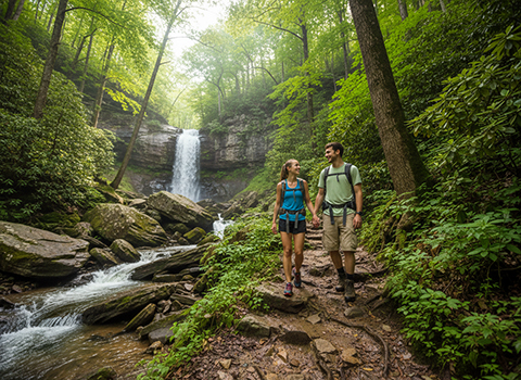
As the trail drops deeper into the hollow, the sound of cascading water grows louder, leading to a series of stone steps and rocky footing near the falls. Dark Hollow Falls is especially striking after rain or during spring snowmelt, when water pours energetically over multiple rock ledges. While the lower viewpoint provides a rewarding look at the falls, more adventurous hikers can carefully scramble farther downstream for different perspectives—though wet rocks and steep slopes require caution.

The return hike is what surprises many visitors, as the trail climbs steadily back to Skyline Drive, turning a leisurely downhill walk into a moderately strenuous uphill finish. This ascent offers a good reminder to pace yourself and carry water, even on shorter hikes. Ideal for families, first-time visitors, or those seeking a scenic break from longer Shenandoah treks, the Dark Hollow Falls Trail combines accessibility, natural beauty, and a classic Blue Ridge waterfall setting in a compact outing.

Devils Marbleyard (Jefferson National Forest)

Hiking the Devils Marbleyard is a challenging and highly distinctive adventure that stands apart from most traditional hiking trails in Virginia. The hike typically begins on the Belfast Trail, where a steady climb through hardwood forest gradually gains elevation alongside a mountain stream. Early sections feel deceptively gentle, but the terrain quickly becomes steeper and rockier, signaling the demanding nature of what lies ahead.
Devils Marbleyard

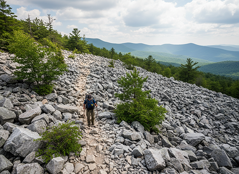
The defining feature of the hike is the Devils Marbleyard itself—a massive slope covered in enormous quartzite boulders that resemble a frozen river of stone. Navigating this rock field requires careful route-finding, balance, and frequent use of hands as hikers scramble upward across shifting and uneven surfaces. There is no single marked path through the boulders, which adds to the sense of exploration but also demands caution, especially in wet or icy conditions. This scramble is strenuous and not suited for casual hikers, yet it delivers a raw, backcountry experience rarely found on maintained trails.

Above the Marbleyard, hikers are rewarded with quieter forest terrain and optional routes that connect to other trails, including access toward the Blue Ridge Parkway area. Views are more subtle than dramatic overlooks, but the sense of accomplishment is substantial after conquering the boulder field. Devils Marbleyard is best suited for experienced hikers seeking solitude, physical challenge, and a unique geological landscape, making it one of the most memorable and demanding hikes in Jefferson National Forest.

Stony Man Trail (Shenandoah National Park)

Hiking the Stony Man Trail is one of the most accessible ways to experience sweeping views in Shenandoah National Park. The trail begins near Skyland along Skyline Drive and follows a gently graded path through oak and hickory forest, making it suitable for a wide range of hikers. With minimal elevation gain and a well-maintained surface, the walk feels relaxed and inviting, offering a peaceful introduction to the park’s high-elevation landscape.
Stony Man Trail

As the trail gradually climbs, it weaves past rocky outcrops and seasonal wildflowers, with occasional openings in the trees that hint at the views ahead. The final approach leads to exposed granite slabs near the summit, where the forest gives way to open sky. This transition from shaded woodland to bare rock is subtle but rewarding, building anticipation without demanding strenuous effort or technical footing.

At the summit, hikers are treated to expansive views over the Shenandoah Valley, Massanutten Mountain, and the rolling ridges of Shenandoah National Park. The overlook is broad and relatively flat, making it an ideal spot to rest, take photos, or enjoy a quiet moment above the treetops. After soaking in the scenery, most hikers return the same way, completing a short, scenic outing that delivers a big payoff. For visitors seeking a classic Shenandoah vista without a long or strenuous hike, the Stony Man Trail is a standout choice.

Humpback Rocks (Blue Ridge Parkway)

Hiking the Humpback Rocks is one of the most iconic short hikes in central Virginia, offering a steep climb with an exceptional scenic payoff. The trailhead is located directly off the Blue Ridge Parkway near milepost 5.8, making access easy for visitors. From the start, the trail ascends sharply through forested terrain, gaining elevation quickly via rocky paths and natural stone steps. Though relatively short, the hike is physically demanding due to its consistent incline.
Humpback Rocks

As the trail climbs, it passes through hardwood forest with occasional glimpses of the valley below, building anticipation for the summit. The final stretch becomes rockier, requiring careful footing as hikers approach the exposed granite outcrops at the top. Despite the effort, the trail remains straightforward and well-marked, making it approachable for hikers with a moderate fitness level who are prepared for a sustained uphill push.

At the summit, Humpback Rocks delivers one of the most dramatic views along the Blue Ridge Parkway, overlooking the Shenandoah Valley, the Rockfish River basin, and layers of Blue Ridge ridgelines stretching into the distance. The broad rock slabs provide plenty of space to sit, relax, and take in the scenery, making the summit a popular spot for photos and rest breaks. After enjoying the view, hikers descend the same way, often finding the downhill just as demanding on the legs. With its combination of accessibility, challenge, and sweeping vistas, Humpback Rocks is a must-do hike for Parkway travelers.

Whiteoak Canyon Trail (Shenandoah National Park)

Hiking the Whiteoak Canyon Trail is one of the most rewarding waterfall hikes in Shenandoah National Park, offering a long, scenic journey through a lush mountain gorge. The trail descends steadily from Skyline Drive into Whiteoak Canyon, following cascading streams and dense hardwood forest. From the outset, hikers are immersed in a cool, shaded environment where mossy rocks, flowing water, and towering trees create a classic Blue Ridge wilderness atmosphere.
Whiteoak Canyon Trail

As the trail continues downward, it passes a series of waterfalls—both upper and lower—each with its own character and setting. Stone steps, stream crossings, and rocky sections add variety to the terrain, keeping the hike engaging throughout. After rainfall or during spring snowmelt, the waterfalls are especially impressive, with water tumbling energetically over cliffs and ledges. Many hikers choose to turn around at one of the falls, while others continue deeper into the canyon to experience the full sequence of cascades.

The challenge of the Whiteoak Canyon Trail is most evident on the return, as the steady descent becomes a demanding uphill climb back to Skyline Drive. This ascent can be strenuous, especially on warm days, making water, pacing, and sturdy footwear essential. Despite the effort, the combination of multiple waterfalls, forested beauty, and a true sense of backcountry immersion makes Whiteoak Canyon one of the most memorable hikes in Shenandoah National Park. For hikers seeking both scenery and physical challenge, it stands out as a must-do trail.

Mount Rogers via Grayson Highlands (Mount Rogers National Recreation Area)

Hiking Mount Rogers via Grayson Highlands offers one of the most unique and scenic hiking experiences in the southern Appalachians. The approach typically begins in the open highlands, where rolling meadows, scattered rock outcrops, and expansive skies create a landscape unlike anywhere else in Virginia. Unlike many summit hikes that start in dense forest, this route immediately rewards hikers with long views across ridgelines and valleys, giving the hike a wide-open, almost alpine feel.
Mount Rogers via Grayson Highlands

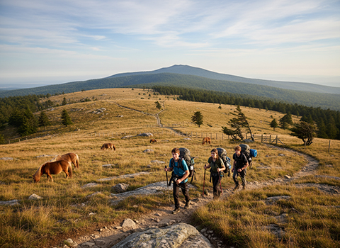
As the trail winds through Grayson Highlands, hikers often encounter the area’s famous wild ponies grazing freely among the grasses and boulders. The terrain alternates between grassy paths, rocky ridges such as Wilburn Ridge, and gentle climbs that feel more exploratory than strenuous. Eventually, the route transitions into thicker spruce-fir forest as it approaches Mount Rogers itself, signaling entry into the highest-elevation ecosystem in Virginia. The cooler temperatures and evergreen canopy create a dramatic contrast to the sunlit highlands below.

The summit of Mount Rogers is subtle compared to many peaks, marked by a small sign within dense forest rather than a dramatic overlook. While there are no sweeping views at the very top, the sense of accomplishment comes from standing at the highest point in Virginia and experiencing the surrounding high-elevation wilderness. Many hikers combine Mount Rogers with a loop through Grayson Highlands to maximize scenery, making the journey as rewarding as the destination. With its mix of open vistas, wildlife encounters, and quiet forest, this hike is a standout experience in the Mount Rogers National Recreation Area.