The Hiking Man Hikes Texas

The Urban Trail Hiker
Hiking in Texas offers an incredible range of landscapes, from arid desert mountains and piney woods to coastal plains and rolling hill country. In Big Bend National Park, hikers can explore remote desert trails, towering canyons, and high mountain ridges, with highlights like the Lost Mine Trail and Emory Peak. Guadalupe Mountains National Park, home to Texas’s highest point, Guadalupe Peak, offers rugged, scenic treks through limestone cliffs and fossil-rich terrain. In central Texas, the Hill Country features scenic river trails and wildflower-covered paths in places like Pedernales Falls State Park and Enchanted Rock. Meanwhile, the pine forests of East Texas and coastal wetlands near Galveston provide entirely different hiking experiences. With its immense size and ecological diversity, Texas delivers hiking adventures for every type of explorer.

Lost Mine Trail (Big Bend National Park)

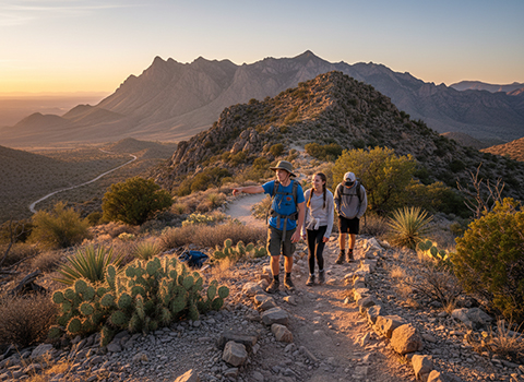
Hiking the Lost Mine Trail in Big Bend National Park offers one of the most rewarding short hikes in the Chisos Mountains, combining steady elevation gain with sweeping desert-to-mountain views. The trail is roughly 4.8 miles round trip with about 1,100 feet of elevation gain, making it moderately strenuous despite its relatively modest length. Beginning near the Basin area, the path quickly leaves the desert floor behind, climbing through shaded switchbacks lined with juniper, oak, and pinyon pine—vegetation that feels worlds away from the sun-baked lowlands of Big Bend.
Lost Mine Trail

As the trail ascends, hikers are treated to a series of increasingly dramatic overlooks. Openings in the forest reveal expansive views of Casa Grande, Juniper Canyon, and the vast Chihuahuan Desert stretching toward Mexico. The contrast between rugged volcanic peaks and the immense arid landscape below is one of the defining features of this hike. Benches placed at scenic viewpoints make ideal rest stops, allowing time to appreciate the quiet, wind-swept solitude that characterizes the Chisos Mountains.

The trail culminates at a high overlook near Lost Mine Peak, where panoramic views reward the final climb. From this vantage point, the surrounding mountains appear layered and sculpted, especially striking in early morning or late afternoon light. Because of its popularity and limited parking, starting early is highly recommended, particularly in warmer months. Overall, the Lost Mine Trail is a standout Big Bend hike—short enough for a half-day outing, yet rich in scenery and elevation changes that showcase the park’s remarkable diversity.

South Rim Trail (Big Bend National Park)

Hiking the South Rim Trail in Big Bend National Park is widely considered one of the most spectacular backcountry experiences in Texas. Located high in the Chisos Mountains, the South Rim is typically reached as part of a longer loop—often via the Pinnacles or Laguna Meadow Trails—making it a demanding hike that ranges from 12 to 15 miles round trip depending on the route chosen. The elevation gain is significant, but the climb carries hikers from desert scrub into cool, forested mountain terrain dominated by pine, oak, and juniper, offering a dramatic ecological transition rarely seen elsewhere in the park.
South Rim Trail

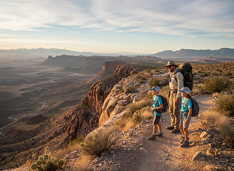
Upon reaching the rim, the trail traces the edge of towering cliffs that drop thousands of feet into the vast Chihuahuan Desert below. The views from the South Rim are expansive and humbling, stretching across the Rio Grande Valley and deep into Mexico’s Sierra del Carmen mountains. On clear days, layers of desert ridges fade into the horizon, emphasizing the immense scale and isolation of the region. The rim’s exposed vantage points provide frequent opportunities to pause, rest, and take in the silence broken only by wind and the occasional call of a bird.

Many hikers choose to backpack and camp along the South Rim, allowing time to experience sunrise and sunset from one of the most dramatic overlooks in the park. Evening light paints the desert in deep reds and purples, while nighttime reveals exceptionally dark skies filled with stars. Because of its length, elevation, and remoteness, careful planning is essential, including water management and weather awareness. For those prepared for the challenge, the South Rim Trail delivers a defining Big Bend experience—remote, strenuous, and unmatched in scenic grandeur.

Enchanted Rock Summit Trail (Enchanted Rock State Natural Area)

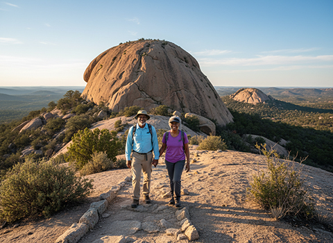
Hiking the Enchanted Rock Summit Trail at Enchanted Rock State Natural Area is a short but memorable climb to the top of one of Texas’s most iconic geological landmarks. The trail is about 0.8 miles round trip, but despite its brief length, it gains roughly 425 feet in elevation over smooth pink granite. The exposed rock surface makes the ascent feel steeper than the mileage suggests, especially under the Texas sun, so sturdy footwear and plenty of water are important even for this relatively quick hike.
Enchanted Rock Summit Trail

As hikers climb the massive granite dome, views open rapidly in all directions. The surrounding Hill Country unfolds below, revealing rolling terrain, scattered live oaks, and distant ridgelines that seem to stretch endlessly. The bare rock underfoot is etched with natural grooves and shallow depressions—vernal pools that collect rainwater and support unique plant life. These features, combined with the vast open views, give the hike an almost otherworldly feel, especially on clear mornings or breezy afternoons.

Reaching the summit is the highlight of the hike, offering panoramic views that are especially striking at sunrise or sunset when the granite glows warm pink and orange. The top of Enchanted Rock feels surprisingly expansive, inviting hikers to linger, explore, and take in the quiet. Because the trail is popular and entirely exposed, starting early and checking weather conditions is recommended. Overall, the Enchanted Rock Summit Trail delivers an outsized reward for a relatively short effort, making it one of the most accessible and scenic hikes in central Texas.

Window Trail (Big Bend National Park

Hiking the Window Trail in Big Bend National Park is one of the most accessible and iconic walks in the Chisos Basin, offering dramatic scenery in a relatively short distance. The trail is about 5.6 miles round trip with roughly 800 feet of elevation change, descending steadily from the basin floor toward a natural pour-off known as “The Window.” Although the hike trends downhill on the way out, the return climb can feel strenuous, particularly in warm weather, making pacing and hydration important.
 Window Trail

As the trail winds through desert scrub, oak, and juniper, it gradually opens to expansive views framed by steep canyon walls. Along the way, hikers pass striking rock formations and dry washes that hint at the powerful seasonal storms that shape this landscape. The terrain feels increasingly rugged as the trail drops deeper into the drainage, and the sense of scale grows as the surrounding cliffs rise higher and the sky narrows toward the horizon.

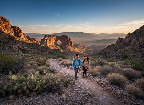
The trail ends at The Window viewpoint, a polished stone ledge where water funnels out of the mountains during rains, perfectly framing the desert beyond. This overlook is especially famous for sunsets, when light pours through the narrow opening and illuminates distant ridges and plains. Extreme caution is required near the edge, as the slick rock and steep drop-offs can be dangerous, particularly after rain. Overall, the Window Trail delivers a classic Big Bend experience—combining geological drama, desert beauty, and one of the park’s most memorable viewpoints.

Guadalupe Peak Trail (Guadalupe Mountains National Park)

Hiking the Guadalupe Peak Trail in Guadalupe Mountains National Park is a challenging and rewarding journey to the highest point in Texas. The trail is about 8.4 miles round trip with roughly 3,000 feet of elevation gain, making it a strenuous hike that demands good fitness and preparation. Beginning near Pine Springs Visitor Center, the path climbs steadily through desert terrain, with long switchbacks that quickly gain elevation and offer expanding views over the surrounding basins.
Guadalupe Peak Trail

As the trail ascends, the landscape transitions from arid lowland scrub to rocky slopes dotted with hardy grasses and mountain vegetation. The climb is relentless, but frequent overlooks provide opportunities to rest and take in sweeping vistas of the Chihuahuan Desert and the rugged spine of the Guadalupe Mountains. Strong winds are common at higher elevations, and weather can change rapidly, so layers and plenty of water are essential for a safe and comfortable hike.

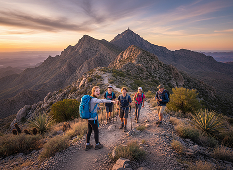
The summit of Guadalupe Peak is marked by a distinctive stainless-steel pyramid, commemorating the peak’s status as Texas’s high point. From the top, hikers are rewarded with panoramic views stretching for miles in every direction, including distant desert flats and sharply defined ridgelines. On clear days, the sense of elevation and isolation is striking, making the long climb feel well worth the effort. Overall, the Guadalupe Peak Trail offers a classic high-point hike—physically demanding, scenic throughout, and deeply satisfying for those who reach the summit.

Pedernales Falls Trail (Pedernales Falls State Park)

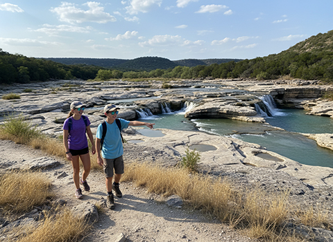
Hiking the Pedernales Falls Trail in Pedernales Falls State Park offers a scenic walk through classic Texas Hill Country terrain centered around the striking Pedernales River. The main trail to the falls is relatively short and accessible, making it suitable for a wide range of hikers, while still delivering impressive natural features. The path winds through open grasslands and stands of juniper and live oak, with gently rolling terrain that provides an easy introduction to the park’s rugged limestone landscape.
/Pedernales Falls Trail

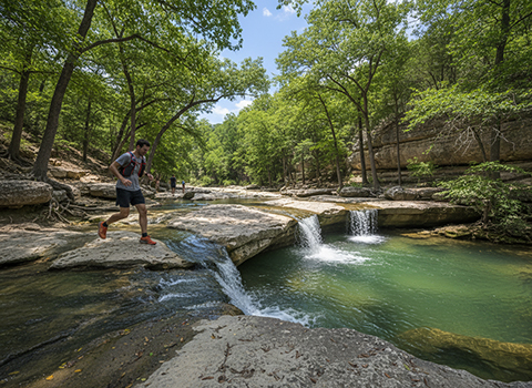
As hikers approach the river, the sound of moving water becomes more prominent, leading to the broad expanse of the falls themselves. Rather than a single vertical drop, Pedernales Falls consists of wide, terraced limestone slabs where water cascades and slides downstream, especially dramatic after periods of rain. The exposed rock formations create a unique visual contrast between smooth stone, rushing water, and the surrounding greenery, making the area one of the most photographed spots in the park.

The trail continues along the river, offering multiple viewpoints and opportunities to pause and take in the scenery. Because of sudden water releases and flash flooding, swimming in the falls area is prohibited, and visitors should stay well back from the slippery limestone edges. Morning and late afternoon are ideal times to hike, when temperatures are cooler and light reflects beautifully off the water and rock. Overall, the Pedernales Falls Trail is a relaxed yet visually rich hike that highlights the geological character and natural beauty of central Texas.

Gorman Falls Trail (Colorado Bend State Park)

Hiking the Gorman Falls Trail in Colorado Bend State Park leads to one of the most striking waterfalls in central Texas. The trail is about 3 miles round trip and is considered moderately strenuous, not because of extreme elevation gain, but due to rocky footing, uneven terrain, and a steep descent near the end. Starting from the trailhead, hikers move through classic Hill Country scenery—open cedar breaks, oak groves, and limestone outcrops—before the landscape gradually funnels toward the river canyon.
Gorman Falls Trail

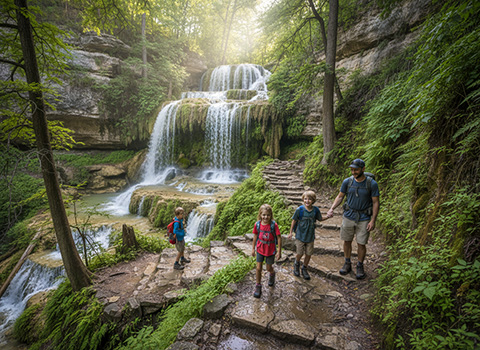
As the trail approaches the falls, the environment becomes cooler and more enclosed, with moss-covered rocks and lush vegetation hinting at the water ahead. The final descent involves narrow paths, exposed rock, and occasional use of cables or handholds, requiring careful footing and attention. While this section can be challenging, it adds a sense of adventure and makes reaching the falls feel especially rewarding.

Gorman Falls itself is a dramatic 65-foot spring-fed waterfall that pours over a limestone cliff into a shaded grotto below. Unlike many seasonal Texas waterfalls, it flows year-round, creating a vivid contrast between green moss, white mineral deposits, and turquoise-tinted water. Swimming at the base of the falls is not allowed to protect the fragile ecosystem, but the viewing area provides an excellent place to rest and take in the scenery. Overall, the Gorman Falls Trail offers a memorable combination of rugged hiking and rare Hill Country waterfall beauty, making it a standout destination within Colorado Bend State Park.

Eagle Point Trail (Caprock Canyons State Park)

Hiking the Eagle Point Trail in Caprock Canyons State Park offers a short but visually impressive introduction to the dramatic landscapes of the Texas Panhandle. This trail is relatively easy and family-friendly, following a mostly level path that skirts the canyon rim. Despite its modest length, the trail delivers immediate rewards, with expansive views opening almost as soon as hikers step onto the path.
Eagle Point Trail

As the trail progresses, it traces the edge of rugged red-rock canyons carved by centuries of erosion. Sheer cliffs, layered sandstone formations, and sweeping canyon vistas dominate the scenery, especially striking in the early morning or late afternoon light. The open terrain provides excellent opportunities for wildlife viewing, including birds of prey that often soar on thermal updrafts rising from the canyon below—true to the trail’s name.

At Eagle Point, hikers reach a scenic overlook that provides a panoramic view deep into the heart of Caprock Canyons. The sense of space and isolation is profound, with rolling prairie meeting jagged canyon walls far below. Benches and open viewpoints make this an ideal spot to pause, reflect, and take photos before heading back. Overall, the Eagle Point Trail is a relaxed yet rewarding hike that showcases the park’s dramatic geology and wide-open horizons without requiring a long or strenuous commitment.

Palo Duro Canyon – Lighthouse Trail (Palo Duro Canyon State Park)

Hiking the Lighthouse Trail in Palo Duro Canyon State Park is one of the most iconic and popular hikes in the Texas Panhandle. The trail is approximately 5.8 miles round trip and is considered moderately challenging due to its length, exposed terrain, and sandy sections. Beginning on the canyon floor, the route follows a wide, well-marked path through dramatic red rock walls and layered sedimentary formations that immediately showcase the immense scale of Palo Duro Canyon, often called the “Grand Canyon of Texas".
Palo Duro Canyon Lighthouse Trail

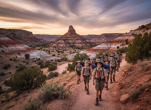
As hikers progress deeper into the canyon, the trail gradually narrows and weaves through colorful badlands, dry creek beds, and rocky outcrops. The landscape feels vast and open, with minimal shade, making sun protection and water essential—especially during warmer months. Along the way, shifting perspectives reveal new angles of the canyon’s cliffs and mesas, while hardy desert plants cling to the arid soil. The sense of distance grows as the Lighthouse formation slowly comes into view, rising distinctly from the surrounding terrain.

The trail culminates at the base of the Lighthouse, a towering rock spire shaped by erosion into its namesake form. Standing beneath it, hikers gain an appreciation for the geological forces that carved Palo Duro Canyon over millions of years. While climbing the formation is prohibited, the area around it offers plenty of space to rest, take photos, and enjoy the quiet grandeur of the canyon. Overall, the Lighthouse Trail delivers a classic Palo Duro experience—long, sunlit, and unforgettable—rewarding hikers with one of Texas’s most recognizable natural landmarks.

Twin Falls and Sculpture Falls via Barton Creek Greenbelt (Austin)

Hiking to Twin Falls and Sculpture Falls via the Barton Creek Greenbelt is one of Austin’s most popular outdoor experiences, blending rugged Hill Country terrain with refreshing creekside scenery. The hike typically begins from access points such as the Twin Falls trailhead or Spyglass Drive and ranges from about 2.5 to 4 miles round trip, depending on the route chosen. The trail is moderately challenging, with rocky footing, limestone ledges, and occasional elevation changes that require sturdy shoes and careful navigation.
Twin Falls via Barton Creek

As hikers follow Barton Creek upstream, the environment alternates between shaded woodland corridors and open limestone shelves. The creek bed often runs dry during hot summer months, but after rainfall it transforms into a series of flowing pools and cascades. Twin Falls appears first, where water spills gently over broad rock steps, creating a scenic and social gathering spot. Continuing farther upstream, the trail becomes slightly rougher, leading to Sculpture Falls, where smooth limestone formations and clear pools create one of the most picturesque sections of the greenbelt.

Sculpture Falls is especially rewarding when water is flowing, offering a tranquil place to relax, swim, or simply enjoy the sound of moving water beneath the trees. Because the area is sensitive to flash flooding, hikers should always check conditions before heading out and avoid the creek during or after heavy rain. Early mornings and weekdays provide a quieter experience, while weekends can be lively with locals enjoying the trail. Overall, the Twin Falls and Sculpture Falls hike showcases the best of Austin’s outdoor culture—accessible, scenic, and deeply connected to the natural rhythms of Barton Creek.