The Hiking Man Hikes Tennessee

The Urban Trail Hiker
Hiking in Tennessee offers a rich and varied experience, from misty mountain summits to cascading waterfalls and rolling forested hills. The state is home to a large portion of Great Smoky Mountains National Park, the most visited national park in the U.S., where trails like Alum Cave, Charlies Bunion, and the iconic Clingmans Dome provide breathtaking views, wildflower-covered meadows, and encounters with Appalachian wildlife. In Middle Tennessee, parks like Fall Creek Falls and Cummins Falls offer scenic gorge hikes and dramatic waterfalls. The Cumberland Trail stretches for hundreds of miles across the rugged Cumberland Plateau, showcasing cliffs, caves, and sweeping overlooks. Whether you're looking for a challenging mountain trek or a peaceful woodland walk, Tennessee’s hiking trails are as diverse as they are beautiful.

Alum Cave Trail to Mount LeConte (Great Smoky Mountains National Park)

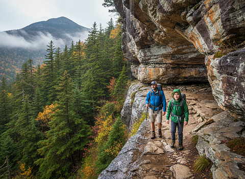
Hiking the Alum Cave Trail to Mount LeConte in Great Smoky Mountains National Park is one of the park’s most iconic and rewarding experiences. The trail begins near Newfound Gap Road and immediately immerses hikers in a lush hardwood forest, following the steady rush of Alum Cave Creek. Early highlights include the narrow stone staircase through Arch Rock, a natural tunnel carved by water over centuries, setting the tone for the dramatic geology that defines the route. The trail is well-maintained and heavily traveled, making it approachable for experienced hikers while still offering a true backcountry feel.
Alum Cave Trail to Mount LeConte

As the elevation increases, the scenery becomes increasingly dramatic, culminating at the Alum Cave Bluffs. These massive concave rock formations loom overhead, providing both a natural shelter and one of the most memorable viewpoints in the Smokies. From this point, the trail steepens and transitions through spruce-fir forest, a cooler, high-elevation ecosystem more reminiscent of northern Appalachia. Switchbacks ease the climb somewhat, but the ascent remains demanding, rewarding persistence with quieter surroundings and occasional glimpses through the trees.

Reaching the summit area of Mount LeConte is a satisfying payoff, with several spur trails leading to overlooks such as Myrtle Point and Cliff Tops, each offering sweeping views of layered blue ridges stretching to the horizon. The presence of LeConte Lodge adds a unique historical character, reminding hikers of the mountain’s long-standing role in Appalachian hiking culture. Whether tackled as a long day hike or savored slowly with time at the top, the Alum Cave Trail delivers a classic Smokies experience—rich in natural beauty, geological intrigue, and a sense of accomplishment that lingers long after the descent.

Charlies Bunion via Appalachian Trail (Great Smoky Mountains)

Hiking to Charlie’s Bunion via the Appalachian Trail is one of the most classic ridge walks in Great Smoky Mountains National Park, offering expansive views and a strong sense of high-country wilderness. The hike typically begins at Newfound Gap, where the Appalachian Trail immediately climbs along the narrow spine of the Smokies. From the outset, hikers are treated to long ridgeline stretches through spruce-fir forest, cooler temperatures, and frequent breaks in the trees that hint at the dramatic scenery to come. The trail is well-defined but steadily rolling, making it feel longer than the mileage alone might suggest.
Charlies Bunion via Appalachian Trail

As the route continues northeast, the forest opens intermittently to reveal sweeping vistas into both Tennessee and North Carolina. The terrain alternates between packed dirt, exposed roots, and rocky sections, demanding steady footing but rewarding attentiveness with constant visual interest. The hike gains character from its elevation—often above 5,500 feet—where weather can change quickly and winds are common. Along the way, hikers may encounter wildlife such as birds, deer, or even black bears, underscoring the importance of awareness and preparedness in this heavily protected backcountry.

Charlie’s Bunion itself is a dramatic, rocky outcrop formed by a massive landslide in the early 20th century, and it stands as one of the most striking viewpoints in the park. From the exposed rocks, hikers are rewarded with panoramic views of deep valleys, jagged ridgelines, and the unmistakable layered blues of the Smokies stretching into the distance. The combination of airy exposure, geological history, and sheer scale makes this destination unforgettable. Whether visited on a clear summer day or amid swirling mountain clouds, the hike to Charlie’s Bunion delivers a quintessential Appalachian Trail experience—rugged, scenic, and deeply immersive.

Laurel Falls Trail (Great Smoky Mountains)

Hiking the Laurel Falls Trail is one of the most accessible and popular short hikes in Great Smoky Mountains National Park, making it a favorite for families and first-time visitors. The trail begins along Little River Road and follows a paved path through a scenic hardwood forest, gently climbing alongside Laurel Branch. Despite its relatively short distance, the trail quickly immerses hikers in classic Smokies scenery, with mossy rocks, rushing water, and dense vegetation creating a lush, shaded environment for much of the walk.
Laurel Falls Trail

As the trail ascends, it offers occasional glimpses of the creek cascading below and passes through stands of mountain laurel, from which the trail and waterfall get their name. During late spring, these shrubs burst into bloom, adding bright splashes of white and pink along the path. The paved surface makes the hike more approachable than many others in the park, but the steady uphill grade can still be moderately challenging, especially on the return trip. Due to its popularity, the trail is often busy, particularly during peak seasons and midday hours.

The destination is Laurel Falls, an 80-foot-high waterfall split into upper and lower sections by a pedestrian footbridge. The sound of falling water grows louder as hikers approach, building anticipation before the dramatic reveal of the cascading falls plunging over rocky ledges. The bridge offers an ideal vantage point for photos and quiet moments of appreciation, though visitors should remain cautious on wet rocks near the water. While short, the Laurel Falls Trail delivers a rewarding experience that showcases the natural beauty of the Smokies in a compact, memorable hike.

Clingmans Dome Observation Tower Trail

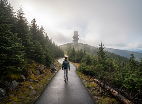
Hiking the Clingmans Dome Observation Tower Trail is a short but memorable experience in Great Smoky Mountains National Park, leading visitors to the highest point in the park and in Tennessee. The trail begins at the Clingmans Dome parking area and follows a fully paved path that climbs steadily through a high-elevation spruce-fir forest. Though only about half a mile long, the trail is quite steep, making the ascent feel more demanding than its distance suggests, especially at elevations over 6,600 feet.
 Clingmans Dome Observation Tower Trail

As hikers progress upward, the surrounding forest creates a cool, misty atmosphere that often feels dramatically different from lower elevations in the Smokies. The air is typically cooler and breezier, and fog or clouds can roll in quickly, sometimes limiting visibility but adding a sense of mystery to the hike. Benches along the way provide opportunities to rest and enjoy the surroundings, and the wide paved surface makes the trail accessible to a broad range of visitors, though it is not fully wheelchair accessible due to its grade.

At the summit, the spiral Clingmans Dome Observation Tower rises above the treetops, offering a 360-degree panoramic view of the Smoky Mountains on clear days. From the top, hikers can see wave after wave of blue-tinged ridgelines stretching across Tennessee and North Carolina, with visibility that can exceed 100 miles under ideal conditions. Even when clouds obscure the view, standing at the highest point in the park is a rewarding experience. The Clingmans Dome Observation Tower Trail delivers big scenery and a true sense of elevation in a short, iconic hike.

Chimney Tops Trail (Great Smoky Mountains)

Hiking the Chimney Tops Trail is one of the most exhilarating and challenging short hikes in Great Smoky Mountains National Park. The trail begins along Newfound Gap Road and follows a rushing mountain stream, crossing several footbridges that add charm and a sense of adventure early in the hike. Dense hardwood forest and rhododendron tunnels line the path, while the sound of cascading water accompanies hikers as the trail steadily gains elevation.
Chimney Tops Trail

As the hike continues, the trail becomes noticeably steeper and more rugged, transitioning from packed dirt to rocky steps and exposed roots. The final ascent is particularly demanding, requiring careful footing and strong legs as the trail climbs sharply toward the summit area. Although the original stone pinnacles are no longer accessible due to safety closures, the designated overlook still delivers a dramatic payoff. The elevation gain over a short distance makes this hike feel strenuous, but it also contributes to the rewarding sense of accomplishment at the top.

From the overlook, hikers are treated to sweeping views of Sugarland Mountain, Mount LeConte, and the surrounding Smoky Mountain ridgelines. The exposed rock and open vista create one of the most photographed scenes in the park, especially during clear mornings or golden-hour light. Weather conditions can change quickly, and strong winds are common near the top, adding to the alpine feel of the hike. The Chimney Tops Trail offers a powerful combination of rushing streams, steep climbs, and expansive views, making it a standout experience for hikers seeking a short but intense Smokies adventure.

Grotto Falls Trail (Great Smoky Mountains)

Hiking the Grotto Falls Trail offers a refreshing and family-friendly adventure in Great Smoky Mountains National Park, following the lively flow of Roaring Fork through a shaded, mossy forest. The trailhead is accessed from the Roaring Fork Motor Nature Trail, immediately immersing hikers in classic Smokies scenery filled with rushing water, boulders, and dense hardwoods. The path is well-defined and gently climbs as it parallels the stream, making the hike approachable while still feeling like a true mountain walk.
Grotto Falls Trail

As the trail winds deeper into the forest, hikers cross footbridges and pass smaller cascades and pools that add constant visual interest. Rhododendron and hemlock trees create a cool, green corridor, especially inviting during warm summer months. The steady incline is moderate but noticeable, and roots and rocks can make sections slick after rain, so careful footing is important. In winter, the trail can become icy, transforming the surrounding water features into striking frozen formations that draw adventurous hikers and photographers.

The highlight of the hike is Grotto Falls itself, a 25-foot waterfall unique in the Smokies because the trail passes directly behind the curtain of falling water. Standing beneath the rocky overhang while water spills just feet away creates an immersive and memorable experience unlike most waterfall hikes. The mist, sound, and close-up perspective make this spot especially rewarding, whether visited during spring runoff or a quieter autumn day. Grotto Falls Trail combines accessibility, lush forest scenery, and an interactive waterfall experience, making it one of the most charming hikes in the park.

House Mountain Trail (Knox County)

Hiking the House Mountain Trail offers a rewarding local escape just outside Knoxville at House Mountain State Natural Area. As the highest point in Knox County, House Mountain rises prominently above the surrounding landscape, providing a true mountain-hike feel despite its proximity to the city. The trail begins with a steady climb through mixed hardwood forest, quickly gaining elevation and setting expectations for a workout-oriented hike rather than a leisurely stroll.
House Mountain Trail

As hikers ascend, the trail becomes steeper and more rugged, with rocky sections and exposed roots requiring careful footing. The route follows the ridgeline in places, opening occasional views through the trees that hint at the scenery to come. Seasonal changes dramatically shape the experience—spring brings wildflowers and fresh green growth, summer offers dense shade, autumn delivers colorful foliage, and winter reveals broader views once leaves have fallen. The terrain and elevation gain make this hike moderately strenuous, but the effort is well balanced by the solitude and natural character of the area.

At the summit, hikers are rewarded with sweeping views of Knoxville, the Tennessee River Valley, and the distant ridges of the Appalachians on clear days. The open rock outcrops near the top provide ideal resting spots to take in the panorama and appreciate the sense of height gained in a relatively short distance. Despite being close to urban development, House Mountain feels surprisingly wild, making it a favorite for locals seeking challenge, scenery, and a quick immersion into East Tennessee’s natural landscape.

Fiery Gizzard Trail (South Cumberland State Park)

Hiking the Fiery Gizzard Trail in South Cumberland State Park is widely regarded as one of the most scenic and challenging backcountry hikes in Tennessee. Located near Tracy City, this rugged trail plunges hikers into a dramatic gorge carved by the Fiery Gizzard Creek, combining waterfalls, cliffs, and dense forest into a truly wild Appalachian experience. From the outset, the trail quickly leaves civilization behind, descending into the gorge and setting the tone for a demanding but deeply rewarding hike.
Fiery Gizzard Trail

As the trail follows the creek, hikers encounter a constant series of highlights—rocky bluffs rising overhead, crystal-clear pools, and numerous waterfalls cascading over sandstone ledges. The terrain is often rough and uneven, with exposed roots, rock scrambles, and occasional stream crossings that require balance and attention. Sections like Raven Point provide jaw-dropping overlooks of the gorge below, while quieter stretches offer solitude and the soothing sound of flowing water. Seasonal changes greatly affect the trail, with spring bringing heavy water flow and wildflowers, and autumn offering cooler temperatures and vibrant foliage.

The Fiery Gizzard Trail is known not just for its beauty, but for its endurance-testing nature. Elevation changes are frequent and sometimes abrupt, especially near the trail’s exits where steep climbs challenge tired legs. Backpackers often choose to spend a night along the route to fully absorb its scenery, while strong day hikers take pride in completing it in a single push. Whether experienced as a long day hike or an overnight adventure, the Fiery Gizzard Trail delivers a rare combination of raw wilderness, geological drama, and Appalachian character that leaves a lasting impression on those who tackle it.

Virgin Falls Trail (Virgin Falls State Natural Area)

Hiking the Virgin Falls Trail in Virgin Falls State Natural Area is a rewarding journey into one of Tennessee’s most unusual and captivating natural landscapes. The trail begins with a steady descent through mixed hardwood forest, immediately signaling that the return hike will be uphill. As the path winds downward, hikers pass several smaller waterfalls and cascades, building anticipation while showcasing the area’s rich karst geology and abundant flowing water.
Virgin Falls Trail

The middle portion of the hike follows a creek corridor filled with mossy rocks, wooden footbridges, and shaded ravines that feel secluded and tranquil. The terrain is moderately strenuous, with rocky footing and occasional slick spots, especially after rain. Along the way, hikers encounter features like Big Laurel Falls and Sheep Cave Falls, each adding character and beauty to the route. The constant sound of water and dense forest canopy create a cool, immersive environment that feels far removed from nearby roads and towns.

The highlight of the trail is Virgin Falls itself, a dramatic 110-foot waterfall that spills from a cave opening before disappearing back underground into another cavern below. This rare phenomenon—where a waterfall both emerges from and vanishes into the earth—makes Virgin Falls one of the most unique waterfalls in the eastern United States. The pool and surrounding rock walls provide a stunning place to rest, reflect, and take in the power of the landscape. Though the climb back out is demanding, the Virgin Falls Trail offers an unforgettable experience defined by geological wonder, solitude, and a true sense of backcountry adventure.

Savage Day Loop (Savage Gulf State Natural Area)

Hiking the Savage Day Loop in Savage Gulf State Natural Area is a rugged and scenic adventure that showcases some of the most dramatic canyon landscapes on the Cumberland Plateau. The loop is often accessed from the Savage Gulf Ranger Station area and quickly leads hikers into a remote-feeling backcountry defined by steep sandstone walls, dense forest, and deep gorges. From the beginning, the trail sets expectations with rocky footing and elevation changes that make it clear this is a hike for those comfortable with strenuous terrain.
Savage Day Loop trail

As the loop descends into the gulf, hikers encounter long stone staircases, narrow trail corridors, and shaded creek bottoms that feel cool and secluded even on warm days. Big Creek and its tributaries add constant visual and auditory interest, while towering cliffs rise overhead in places, emphasizing the scale of the canyon. The trail alternates between demanding climbs and gentler stretches along the valley floor, rewarding effort with striking overlooks and quiet moments of solitude. Seasonal conditions greatly influence the hike, with spring bringing flowing water and wildflowers, and autumn offering crisp air and colorful foliage.

The climb back out of the gulf is the defining challenge of the Savage Day Loop, requiring steady pacing and endurance as the trail gains significant elevation over a relatively short distance. Reaching the rim brings a renewed sense of openness, with expansive forest views and a satisfying contrast to the enclosed canyon below. This loop delivers a true backcountry experience—physically demanding, visually dramatic, and deeply immersive. For hikers seeking one of Tennessee’s most rewarding day hikes, the Savage Day Loop offers a powerful blend of challenge and natural beauty.