The Hiking Man Hikes Georgia

The Urban Trail Hiker
Hiking in Georgia offers a rewarding mix of mountain views, lush forests, cascading waterfalls, and rich biodiversity. The state is home to the southern terminus of the Appalachian Trail at Springer Mountain, making it a popular starting point for long-distance hikers as well as those seeking scenic day hikes. In North Georgia, the Chattahoochee National Forest and Blue Ridge Mountains provide rugged terrain, panoramic overlooks, and well-marked trails like Blood Mountain, Brasstown Bald, and the Raven Cliff Falls Trail. Farther south, trails wind through state parks, wetlands, and coastal areas, offering diverse hiking environments. With its range of elevations and habitats, Georgia is a fantastic destination for hikers of all levels and interests..

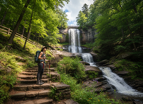
Amicalola Falls Loop Trail

Hiking the Amicalola Falls Loop Trail offers an unforgettable introduction to the dramatic terrain of North Georgia’s southern Appalachians. Located within Amicalola Falls State Park, the loop showcases the park’s most iconic feature—Amicalola Falls, the tallest waterfall in Georgia, plunging more than 700 feet in a series of cascades. The trail combines forested paths, observation decks, and stair climbs, allowing hikers to experience the falls from multiple perspectives while moving through lush hardwood forests filled with rhododendron, moss-covered rocks, and seasonal wildflowers.
Amicalola Falls Loop Trail

The hike is moderately strenuous, largely due to the famous stair section that climbs alongside the falls. These stairs provide close-up views of rushing water and misty spray, making the ascent both challenging and rewarding. As the loop continues away from the falls, the trail becomes quieter and more natural, winding through shaded woodland with rolling elevation changes. Along the way, hikers may spot songbirds, deer, or signs of other wildlife, especially in the early morning or cooler months when the forest is most active.

What makes the Amicalola Falls Loop Trail especially appealing is its balance of accessibility and adventure. Well-maintained surfaces and clear signage make it manageable for most hikers with reasonable fitness, while the elevation gain still delivers a satisfying workout. The trail is beautiful year-round—vibrant green in spring and summer, ablaze with color in autumn, and starkly scenic in winter when bare trees reveal sweeping views. Whether you’re seeking a scenic day hike, a leg-burning climb, or a memorable introduction to Georgia’s mountain landscapes, this loop delivers a rich and rewarding experience.

Blood Mountain via Byron Reece and Appalachian Trails

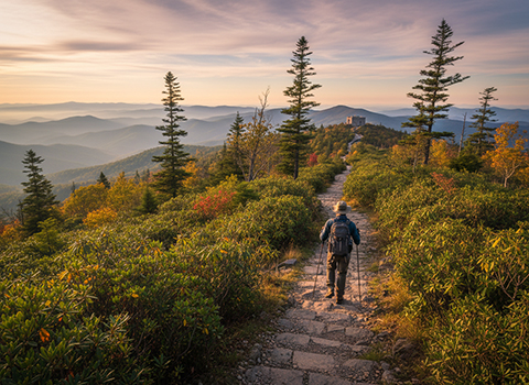
Hiking Blood Mountain via the Byron Reece and Appalachian Trails is one of North Georgia’s most iconic and rewarding mountain hikes. Beginning at the Byron Reece Trailhead in the Chattahoochee National Forest, the route climbs steadily through hardwood forest before transitioning into rockier, high-elevation terrain. As the highest peak on Georgia’s portion of the Appalachian Trail, Blood Mountain holds special significance for long-distance hikers and day hikers alike, offering a true Appalachian summit experience.
Byron Reece Trail

The Byron Reece Trail provides a direct and scenic ascent, featuring stone steps, exposed roots, and increasingly rugged rock formations as elevation is gained. Near the summit, the trail intersects with the Appalachian Trail, where hikers are rewarded with panoramic views stretching across the Blue Ridge Mountains. The exposed granite outcrops near the top create a dramatic alpine feel uncommon in Georgia, and the historic stone shelter at the summit adds a sense of legacy and connection to the generations of hikers who have passed through this crossroads.

This hike is considered moderately strenuous due to its elevation gain and rocky footing, but it remains accessible to most hikers with reasonable fitness and preparation. Spring and summer bring lush greenery and cooler summit breezes, while fall offers spectacular foliage views that make the climb especially popular. Winter can add icy conditions, transforming the trail into a more technical challenge. Whether approached as a challenging day hike or a meaningful stop along the Appalachian Trail, the Blood Mountain route via Byron Reece delivers outstanding scenery, history, and a true sense of mountain accomplishment.

Tallulah Gorge North and South Rim Trails

Hiking the North and South Rim Trails at Tallulah Gorge State Park offers one of the most dramatic and awe-inspiring hiking experiences in Georgia. Carved by the Tallulah River, the gorge plunges nearly 1,000 feet deep, creating sheer cliffs, roaring waterfalls, and sweeping canyon views. Both rim trails provide a series of overlooks that allow hikers to safely admire the gorge’s immense scale, with panoramic vistas that change subtly as you move along the edges of this rugged natural wonder.
Tallulah Gorge Trail

The North Rim Trail is generally quieter and more shaded, winding through forested terrain with several scenic overlooks that feel slightly more remote. It offers excellent views of the gorge’s upper sections and waterfalls, making it a favorite for photographers and hikers seeking a calmer experience. The South Rim Trail, by contrast, is more developed and popular, featuring paved and gravel sections that lead to iconic overlooks such as Inspiration Point. From here, hikers gain dramatic views straight down into the gorge, as well as across to the opposing rim, clearly illustrating the canyon’s depth and steep walls.

Together, the North and South Rim Trails provide a balanced and accessible way to experience Tallulah Gorge without committing to the strenuous inner-gorge descent. While the rim trails are rated easy to moderate, they still deliver constant visual rewards and interpretive signage that highlights the area’s geology, ecology, and history. In spring, waterfalls surge with snowmelt and rain; in autumn, the gorge is framed by vibrant fall foliage. Whether walked individually or combined into a longer outing, the rim trails offer an unforgettable perspective on one of the Southeast’s most spectacular landscapes.

Raven Cliff Falls Trail – Near Helen

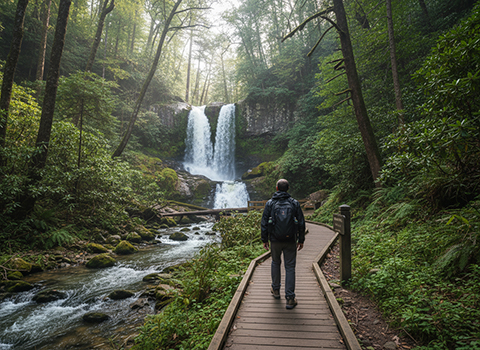
Hiking the Raven Cliff Falls Trail near Helen is a scenic and immersive journey into the lush forests of North Georgia. Located within the Chattahoochee National Forest, this out-and-back trail follows the clear, fast-moving waters of Dodd Creek through a shaded valley of hardwoods and hemlocks. From the very beginning, hikers are treated to the soothing sounds of rushing water, mossy rocks, and fern-lined banks, making the trail feel peaceful and refreshing even on warm days.
 Raven Cliff Falls Trail

The trail is considered moderate and is well known for its series of wooden footbridges that cross Dodd Creek multiple times, adding both charm and visual variety to the hike. As you move deeper into the forest, the terrain gradually becomes rockier and more rugged, but remains manageable for most hikers with basic trail experience. The reward comes at the end: Raven Cliff Falls, a dramatic waterfall that plunges through a narrow cliffside crevice before spilling into a rocky pool below. Unlike wide cascading falls, this slender chute gives the area a unique and striking character.

Raven Cliff Falls Trail is especially popular in spring and after rainfall, when water flow is strongest and wildflowers brighten the forest floor. Summer offers cool shade and creek breezes, while autumn brings vibrant fall colors that reflect beautifully off the water. Though the trail can be busy on weekends, its length and scenery make it feel adventurous and satisfying without being overwhelming. For hikers seeking a classic North Georgia waterfall experience near Helen, this trail delivers beauty, tranquility, and a memorable natural finale.

Panther Creek Falls Trail

Hiking the Panther Creek Falls Trail delivers one of North Georgia’s most rewarding waterfall adventures, combining rugged terrain with deep forest scenery. Located in the Chattahoochee National Forest near Clarkesville, this out-and-back trail winds through dense hardwood forest alongside tumbling creeks and rocky ravines. From the start, the trail feels remote and wild, offering a sense of backcountry immersion that sets it apart from more developed waterfall hikes in the region.
Panther Creek Falls Trail

The hike is considered moderately strenuous, with several creek crossings, rocky sections, and short but steep climbs that require careful footing. Wooden footbridges and narrow paths add to the trail’s adventurous character, especially after rain when water levels rise and the forest feels alive with sound. As the trail descends toward the falls, the roar of cascading water grows louder, building anticipation for the dramatic finale waiting ahead.

At the end of the trail, Panther Creek Falls plunges nearly 100 feet down a rugged rock face into a shaded basin, creating one of the most impressive waterfalls in Georgia. Mist fills the air near the base, and the surrounding cliffs and greenery give the area a secluded, almost untouched feel. Spring and early summer bring strong water flow and lush vegetation, while fall adds brilliant foliage contrast to the gray stone and white water. For hikers seeking a challenging yet deeply scenic trail with a powerful natural reward, Panther Creek Falls offers a memorable and satisfying experience.

Cloudland Canyon West Rim Loop Trail

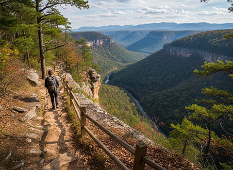
Hiking the West Rim Loop Trail in Cloudland Canyon State Park offers a spectacular journey along the edge of one of Georgia’s deepest and most scenic canyons. Perched high atop Lookout Mountain near the Tennessee border, the trail follows sheer sandstone cliffs that drop dramatically into the canyon below. From the very start, hikers are rewarded with sweeping overlooks that reveal layered rock walls, dense forest canopy, and distant ridgelines stretching across northwest Georgia and into Alabama.
Cloudland Canyon West Trail

The loop combines rugged dirt paths with rocky sections and exposed cliffside walking, making it moderately strenuous but manageable for most hikers with good footwear. Multiple overlooks along the West Rim provide opportunities to pause and take in changing perspectives of the canyon as light and weather shift across the landscape. The trail is well-marked and less crowded than the park’s waterfall routes, creating a quieter, more contemplative hiking experience. Occasional side trails lead to additional viewpoints, adding variety and encouraging exploration.

What makes the West Rim Loop Trail especially memorable is its dramatic, big-sky feel paired with a sense of solitude. In spring and summer, the canyon fills with lush green foliage, while fall transforms the rim into a corridor of vibrant reds, oranges, and golds. Winter hiking reveals unobstructed views through bare trees, emphasizing the canyon’s depth and rugged geology. Whether hiked as a full loop or a shorter out-and-back to select overlooks, the West Rim Trail delivers one of the most visually striking and rewarding hiking experiences in Georgia.

Brasstown Bald Summit Trail

Hiking the Brasstown Bald Summit Trail is a short but memorable climb to the highest point in Georgia, offering expansive views and a true mountaintop experience. Located within the Chattahoochee National Forest, Brasstown Bald rises to 4,784 feet above sea level. The paved trail begins at the parking area and ascends steadily through spruce and hardwood forest, giving hikers a sense of elevation and cooler mountain air even on warm summer days.
Brasstown Bald Summit Trail

The Cascade Pass Trail meanders through subalpine meadows adorned with colorful wildflowers during the summer months, creating a vibrant tapestry against the backdrop of jagged mountain peaks. Along the way, hikers may encounter a variety of wildlife, including marmots, mountain goats, and even elusive black bears, adding to the sense of adventure and immersion in nature. As the trail climbs higher, the views become increasingly dramatic, with each switchback revealing new perspectives of the surrounding landscape.

At the top, hikers are rewarded with a panoramic view from the observation tower, where on clear days it’s possible to see into four states—Georgia, North Carolina, South Carolina, and Tennessee. The summit area offers a dramatic contrast between open sky and rolling Blue Ridge Mountains fading into the distance. Autumn brings spectacular fall color views, while winter often delivers crisp air and occasional snow. Whether you’re seeking an easy introduction to high-elevation hiking or a quick summit with big rewards, the Brasstown Bald Summit Trail delivers an unforgettable perspective on North Georgia’s mountain landscape.

Anna Ruby Falls Trail –Unicoi State Park

Hiking the Anna Ruby Falls Trail in Unicoi State Park is a scenic and accessible walk that showcases one of North Georgia’s most beloved waterfall destinations. The paved, out-and-back trail follows Smith Creek through a cool, shaded valley filled with hardwoods, rhododendron, and moss-covered rocks. From the start, the soothing sound of rushing water accompanies hikers, creating a peaceful atmosphere that makes the trail enjoyable for visitors of all ages and fitness levels.
Anna Ruby Falls Trail

The trail is relatively short but steadily uphill, with gentle elevation gain that adds just enough challenge to feel rewarding without being strenuous. Wooden footbridges and interpretive signs along the way highlight the area’s natural features and wildlife, making the hike both educational and visually engaging. As the trail approaches the falls, the terrain opens slightly, and the sound of cascading water grows louder, building anticipation for the main attraction.

At the end of the trail, hikers are rewarded with views of Anna Ruby Falls, a rare pair of side-by-side waterfalls formed where Curtis Creek and York Creek plunge into a rocky basin below. Observation platforms allow for close-up views of both cascades, offering excellent photo opportunities and a refreshing mist on warm days. Spring brings strong water flow, summer offers cool mountain shade, fall frames the falls with vibrant foliage, and winter adds icy elegance. For those seeking an easy yet unforgettable waterfall hike in North Georgia, the Anna Ruby Falls Trail delivers beauty, accessibility, and a classic mountain experience.

Arabia Mountain Trail – Just east of Atlanta

Hiking the Arabia Mountain Trail offers a strikingly different experience from Georgia’s forested mountain hikes, showcasing a rare and beautiful granite landscape just east of Atlanta. Located within the Arabia Mountain National Heritage Area, the trail winds through rolling woodlands, open meadows, and expansive granite outcrops formed over millions of years. The scenery feels almost otherworldly, with broad stone domes, shallow rock pools, and sweeping views that contrast sharply with the surrounding suburban environment.
Arabia Mountain Trail

The trail system is relatively gentle and well-maintained, making it accessible to hikers of varying skill levels. Much of the route follows paved or smooth gravel paths, while spur trails lead directly onto the granite slabs where footing is open and exposed to the sun. As hikers ascend the mountain, the landscape gradually opens up, revealing panoramic views of nearby lakes, forests, and the Atlanta skyline in the distance on clear days. Seasonal wildflowers, including rare species that thrive in the granite soil, add bursts of color in spring and early summer.

What makes the Arabia Mountain Trail especially memorable is its blend of geology, ecology, and tranquility. The open summit areas invite quiet reflection, photography, and sunset viewing, while the surrounding trails provide opportunities for longer loops and exploration. Autumn brings golden grasses and cooler temperatures, while winter highlights the stark beauty of bare granite against crisp skies. For hikers seeking an easy-to-moderate trail with unique terrain and expansive views, the Arabia Mountain Trail delivers a distinctive and rewarding outdoor experience close to the city.

Providence Canyon Trails (Georgia’s “Little Grand Canyon

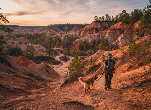
Hiking the Providence Canyon Trails offers a surprisingly dramatic landscape in southwest Georgia, earning the area its nickname as Georgia’s “Little Grand Canyon.” Located within Providence Canyon State Park, the trails wind through towering gullies carved from colorful clay soils. Shades of red, orange, pink, and purple stripe the canyon walls, creating a striking visual contrast that feels more like the American Southwest than the Deep South. The unique formations are the result of severe erosion caused by poor 19th-century farming practices, making the park both visually stunning and historically significant.
Providence Canyon Trail

The main canyon loop trail descends into the gullies, following sandy creek beds and narrow paths beneath steep walls that rise dramatically overhead. While the hike is relatively short, it can be moderately challenging due to loose sand, uneven footing, and elevation changes when climbing in and out of the canyon. Wooden staircases and marked paths help guide hikers safely through the most sensitive areas, while side trails lead to less-visited gullies that offer quieter exploration and equally impressive views.

Providence Canyon is beautiful year-round, but lighting conditions can dramatically change the canyon’s colors, making each visit feel different. Spring brings blooming wildflowers along the rim trails, summer highlights the vivid clay hues, and fall offers cooler temperatures with subtle foliage contrast. After heavy rain, small streams may flow through the canyon floor, adding movement and sound to the landscape. For hikers seeking a short but unforgettable trail experience unlike anywhere else in Georgia, the Providence Canyon Trails deliver geology, history, and scenery all in one remarkable setting.