The Hiking Man Hikes Alaska

The Urban Trail Hiker
Hiking in Alaska offers adventurers an unparalleled and awe-inspiring experience amidst the state's vast and untamed wilderness. With its rugged mountains, ancient glaciers, and pristine forests, Alaska boasts some of the most breathtaking hiking trails on the planet. Whether trekking through the alpine meadows of Denali National Park, exploring the towering peaks of the Chugach Range, or wandering along the rugged coastline of the Kenai Peninsula, hikers are treated to unparalleled vistas, encounters with wildlife, and a deep connection with the natural world.
Moreover, hiking in Alaska allows visitors to immerse themselves in the state's rich history and cultural heritage. Many trails lead to historic sites, such as old mining camps, Native American villages, and remnants of the state's frontier past, providing hikers with a deeper understanding of Alaska's diverse heritage. Beyond the historical landmarks, hiking offers a chance to disconnect from the hustle and bustle of modern life and reconnect with the tranquility of the wilderness. Whether embarking on a challenging trek to reach a remote summit or enjoying a leisurely stroll through a pristine forest, hikers in Alaska find solace and inspiration in the simplicity and beauty of the natural world. With its scenic trails, welcoming parks, and abundant wildlife, Alaska offers a hiking experience that is as enriching as it is enjoyable, leaving visitors with memories of adventure and exploration that last a lifetime.

Harding Icefield Trail (Kenai Fjords National Park)

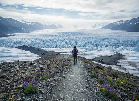
Hiking the Harding Icefield Trail in Kenai Fjords National Park, Alaska, is a demanding but unforgettable experience that rewards effort with some of the most dramatic scenery in North America. The trail begins near Exit Glacier and climbs relentlessly upward, gaining more than 3,000 feet in just over four miles one way. Early sections wind through alder thickets and cottonwood forest before opening into alpine meadows filled with wildflowers in midsummer. As elevation increases, the landscape becomes increasingly stark, offering sweeping views of Exit Glacier spilling down the valley below.
Harding Icefield Trail

As hikers ascend, the trail transitions from soft earth to rocky, exposed terrain where weather can change quickly. Fog, wind, and sudden temperature drops are common, even on sunny days at lower elevations. Along the way, interpretive signs mark viewpoints that overlook crevasses, icefalls, and glacial moraines, providing insight into the immense power of ice shaping the landscape. Wildlife sightings—such as marmots, mountain goats, or even bears in lower elevations—add to the sense of wilderness and reinforce the need for situational awareness and preparedness.

Reaching the top of the Harding Icefield Trail delivers a breathtaking payoff: a seemingly endless expanse of snow and ice stretching to the horizon. The Harding Icefield itself feeds dozens of glaciers, making it one of the largest icefields entirely within the United States. Standing at the overlook, hikers often experience a profound sense of scale and isolation, with nothing but wind, ice, and sky in every direction. While the hike does not require technical climbing, it is physically strenuous and best attempted by well-prepared hikers who respect the conditions, carry proper gear, and understand that turning back is sometimes the wisest decision.

Crow Pass Trail (Chugach State Park)

Hiking the Crow Pass Trail in Chugach State Park offers a remarkable journey through some of south-central Alaska’s most dramatic and varied landscapes. The trail is part of the historic Iditarod Trail system and typically begins near Girdwood, climbing steadily through spruce forest and alpine meadows toward the Crow Pass saddle. As hikers gain elevation, views open to hanging glaciers, waterfalls, and rugged peaks, with the Raven Glacier often dominating the skyline. Wildflowers bloom briefly in summer, contrasting sharply with snowfields that can linger well into July.
Crow Pass Trail

Beyond the pass, the character of the hike shifts as the trail descends into the Eagle River Valley. This section feels remote and expansive, with braided river channels, gravel bars, and wide tundra flats stretching between steep mountain walls. Depending on conditions, hikers may need to ford streams or navigate muddy sections, especially after rain or during snowmelt. Wildlife is common throughout the route—moose, Dall sheep, marmots, and bears are all possible—making bear awareness and proper food storage essential.

The Crow Pass Trail is often completed as a long point-to-point hike or overnight backpacking trip, covering roughly 23 miles from Girdwood to Eagle River. Weather can change rapidly, and snow, fog, or strong winds at higher elevations are not unusual, even in midsummer. While technically non-technical, the trail demands solid fitness, good navigation skills, and respect for Alaska’s unpredictable conditions. For those prepared to meet its challenges, Crow Pass delivers a deeply immersive wilderness experience that blends history, glaciers, and raw mountain scenery into a truly memorable hike.

Mount Marathon Trail (Seward)

Hiking the Mount Marathon Trail in Seward, Alaska, is a steep, rugged adventure that delivers outsized rewards in a very short distance. Famous for the annual Mount Marathon Race held every Fourth of July, the trail climbs more than 3,000 feet in roughly 1.5 miles, making it one of the steepest maintained trails in the state. The route begins abruptly near downtown Seward and quickly ascends through forest before transitioning to rocky slopes and exposed terrain, where hands are often needed for balance and scrambling.
Mount Marathon Trail

As elevation increases, hikers are treated to ever-expanding views of Resurrection Bay, Seward’s harbor, and the surrounding Kenai Mountains. On clear days, the scenery is spectacular, with snow-capped peaks, deep blue water, and glacial valleys stretching into the distance. The trail itself is rough and varied, featuring loose rock, slick mud, roots, and multiple informal paths braided across the hillside. Weather conditions can change rapidly, and fog or rain can significantly increase the difficulty and risk of slips.

Reaching the top of Mount Marathon is both physically demanding and deeply satisfying, offering a panoramic vantage point that feels far removed from the town below. While experienced trail runners often descend quickly, hikers should take extra care on the way down, as most injuries occur during descent. Proper footwear, trekking poles, and a conservative approach are strongly recommended. Though short in mileage, the Mount Marathon Trail is not a casual hike—it is a true test of endurance and footing, best suited for confident hikers who respect Alaska’s steep terrain and variable conditions.

Flattop Mountain Trail (Chugach State Park)

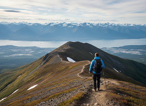
Hiking the Flattop Mountain Trail in Chugach State Park is one of the most popular and accessible ways to experience Alaska’s rugged alpine environment near Anchorage. The trailhead at Glen Alps provides immediate elevation gain, and the well-maintained route climbs steadily through tundra and rocky slopes toward Flattop’s broad, rounded summit. Despite its popularity, the trail quickly offers sweeping views of Anchorage, Cook Inlet, and the Chugach Mountains, making it a favorite for both locals and visitors.
 Flattop Mountain Trail

As hikers ascend, the terrain becomes increasingly rocky and exposed, with sections that require careful footing and occasional scrambling, especially near the top. Weather conditions can shift rapidly, even on days that begin clear and calm, with strong winds and sudden fog common at higher elevations. Along the way, hikers often encounter hardy alpine vegetation and may spot wildlife such as ptarmigan or marmots. The combination of accessibility and real alpine conditions makes Flattop an excellent introduction to mountain hiking in Alaska.

From the summit, hikers are rewarded with expansive panoramic views that stretch from Denali on exceptionally clear days to the waters of Turnagain Arm and beyond. While the main trail ends at the summit, more adventurous hikers can continue along the nearby ridge routes toward Peak 2 or traverse sections of the Front Range for a longer outing. Though often crowded in summer, Flattop Mountain demands respect due to its exposure and weather variability, reminding hikers that even heavily used trails in Alaska require preparation, awareness, and sound judgment.

Winner Creek Trail (Girdwood)

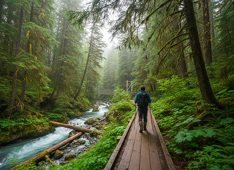
Hiking the Winner Creek Trail near Girdwood offers a scenic and approachable adventure through the lush temperate rainforest of Alaska’s Turnagain Arm region. The trail begins near the Alyeska Resort and follows Winner Creek as it winds through dense stands of spruce and hemlock, with moss-covered ground and frequent views of rushing water. Wooden boardwalks and bridges help navigate wet sections, making the trail accessible to a wide range of hikers while still providing a strong sense of immersion in the forest.
Winner Creek Trail

As hikers continue deeper into the valley, the sound of the creek grows louder and the terrain becomes more dramatic, with steep canyon walls and waterfalls adding to the experience. One of the trail’s highlights is the hand-tram crossing over Winner Creek Gorge, where hikers pull themselves across in a small cable car suspended high above the rushing water below. This unique feature adds a touch of adventure and offers striking views of the gorge, though it may be intimidating for those uncomfortable with heights.

Beyond the gorge, the trail connects with longer routes such as the Crow Pass Trail, allowing hikers to extend their journey into more remote terrain if desired. Wildlife sightings are possible throughout the area, including birds, moose, and occasionally bears, so awareness and proper precautions are important. Whether enjoyed as a short out-and-back hike or as part of a longer backcountry route, the Winner Creek Trail combines natural beauty, light adventure, and easy access, making it a standout hike in the Girdwood area.

Kesugi Ridge Trail (Denali State Park)

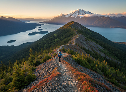
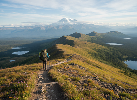
Hiking the Kesugi Ridge Trail in Denali State Park is a classic Alaskan backpacking experience that winds across a high alpine ridge with views of the mighty Alaska Range, including occasional glimpses of Denali itself on clear days. The route runs for roughly 22–30+ miles depending on the access points and route chosen, and it climbs from forested lowlands up onto the exposed tundra of Kesugi Ridge, with varying terrain that includes rolling ridges, rocky sections, and open valleys dotted with alpine lakes and streams. Cairns and trail markers help guide hikers across the more open, rocky sections where the trail can otherwise be hard to follow.
Kesugi Ridge Trail

Most hikers treat Kesugi Ridge as a multi-day backpacking trip, typically taking 3–4 days to complete the full traverse from one trailhead to another, such as from Little Coal Creek to Byers Lake or Ermine Hill. The initial ascent from the tree line to the ridge top is one of the more strenuous parts, but once on the ridge the trail often meanders with sweeping views that reward the effort. Weather in the alpine zone can change quickly—sunny mornings can give way to wind, clouds, or rain—so preparedness with layers, navigation tools, and rain gear is important. June through September are generally the best months to attempt the hike, with summer offering long daylight hours and the greatest chance for clear views.

Beyond its physical challenge, Kesugi Ridge offers a profound sense of wilderness and solitude. The ridge’s open spaces showcase Alaska’s iconic landscapes—tundra, distant snowy summits, and wide skies—with opportunities to spot wildlife such as moose and bear, as well as abundant wild berries later in the season. Because the trail doesn’t loop back to a single starting point, logistical planning for transportation between trailheads or arranging a shuttle is part of the adventure. For experienced hikers prepared for backcountry conditions, Kesugi Ridge is widely regarded as one of the most scenic and rewarding hikes in south-central Alaska.

Savage River Loop Trail (Denali National Park)

Hiking the Savage River Loop Trail in Denali National Park is a serene way to experience the park’s wild river canyon without a major climb or long trek. The trail is a roughly 1.7–2.1 mile loop that stays close to the rushing waters of the Savage River as it cuts a canyon between mountain ridges, offering a gentle walk with only minor rises and falls rather than steep ascents.
Savage River Loop Trail

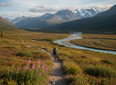
Because the trail is so accessible (located about 15 miles down Denali Park Road), the furthest point private vehicles can reach, it’s a popular choice for visitors of all ages and abilities. You’ll follow a clear path through tundra and along riverbanks, enjoy views of surrounding peaks, and cross a footbridge over the river before looping back to the trailhead. Wildlife viewing is a highlight here; moose, caribou, Dall sheep, and smaller creatures can often be spotted in the area, and birds frequent the willows and riverbanks, making it an especially rewarding hike for nature lovers and photographers.

The gentle terrain and short distance make the Savage River Loop an excellent option for a half-day outing, easily combined with other hikes or activities in the park. Because it lies farther inside Denali than many entry-area trails, it tends to feel quieter and more remote despite its easy access. Just be prepared for typical Alaskan weather—conditions can change quickly—and keep a respectful distance from any wildlife you encounter.

Tony Knowles Coastal Trail (Anchorage)

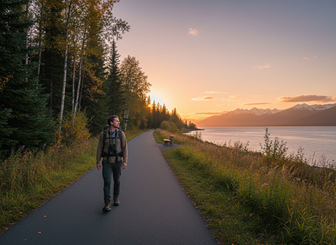
Hiking the Tony Knowles Coastal Trail in Anchorage offers a scenic and accessible way to experience Alaska’s coastal environment right from the heart of the city. Stretching approximately 11 miles along the shores of Cook Inlet, the trail connects downtown Anchorage with Kincaid Park, passing through greenbelts, forests, and open coastal viewpoints along the way. The paved surface and gentle grades make it suitable for hikers of all skill levels, while the proximity to the water provides frequent views of tidal flats, distant mountains, and dramatic skies.
Tony Knowles Coastal Trail

As hikers move along the trail, the landscape shifts between wooded sections and open bluff-top stretches overlooking the inlet. Wildlife sightings are common, even within city limits, with moose occasionally crossing the trail and bald eagles soaring overhead. Interpretive signs highlight local history, geology, and ecology, adding educational value to the walk. On clear days, hikers may catch glimpses of Denali far to the north, while sunsets over Cook Inlet are often a highlight, casting warm light across the mudflats and mountains.


Matanuska Glacier Trail (Matanuska-Susitna Valley)

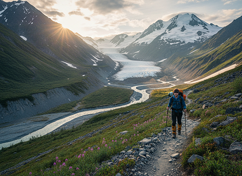
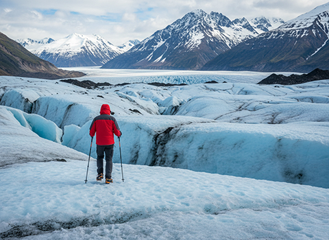
Hiking the Matanuska Glacier Trail in Alaska’s Matanuska–Susitna Valley offers an up-close look at one of the largest and most accessible glaciers in the state. Located along the Glenn Highway, the trail leads hikers across glacial moraine and rocky terrain toward the dramatic ice face of the Matanuska Glacier, which stretches for more than 20 miles. The surrounding landscape is stark and powerful, with jagged ice formations, meltwater streams, and towering mountain backdrops creating a vivid sense of Alaska’s glacial environment.
Matanuska Glacier Trail

As hikers progress along the trail, the ground underfoot reflects the glacier’s influence, shifting between gravel, rock, and packed earth shaped by centuries of ice movement. The trail itself is relatively short, but conditions can change quickly due to weather, meltwater flow, and seasonal ice movement. Interpretive signs in some areas explain glacial processes, helping visitors understand how the glacier advances, retreats, and reshapes the valley. Even without stepping onto the ice, hikers can hear the crack and groan of the glacier, adding to the immersive experience.

For those seeking a deeper adventure, guided hikes allow visitors to safely walk on the glacier itself using crampons and helmets, offering a rare chance to explore ice caves, crevasses, and blue ice formations. Unguided hikers should remain on established paths and respect posted boundaries, as glaciers are dynamic and potentially dangerous environments. Whether enjoyed as a short scenic walk or paired with a guided ice trek, the Matanuska Glacier Trail provides a memorable introduction to Alaska’s glacial landscapes and the raw forces that continue to shape them.

When hiking the Matanuska Glacier Trail, safety begins with respecting that glaciers are dynamic and potentially hazardous environments. Stay on established trails and obey all posted signs, as unstable moraine, loose rock, and sudden meltwater channels can pose serious risks near the ice. Weather can change quickly, so wear sturdy footwear, dress in layers, and bring rain protection even on clear days. Avoid walking onto the glacier unless you are with a qualified guide using proper equipment, as crevasses and ice collapse are often hidden from view. Keep a safe distance from the glacier face due to falling ice and rock, remain alert to your surroundings, and carry basic essentials such as water, snacks, and a charged phone or navigation aid to ensure a safe and enjoyable hike.

Thunderbird Falls Trail (Chugach State Park)

Hiking the Thunderbird Falls Trail in Chugach State Park is a short and rewarding outing that showcases Alaska’s lush forests and rushing waterways. Located north of Anchorage near the Glenn Highway, the trail is an easy walk of about one to two miles round trip, following a wide, well-maintained path through stands of birch, spruce, and cottonwood. The gentle terrain and clear signage make it a popular choice for families, casual hikers, and those looking for a quick nature escape close to the city.
Thunderbird Falls Trail

As the trail approaches Eklutna Creek, hikers reach a viewing platform overlooking Thunderbird Falls, where water plunges dramatically into a narrow gorge below. The falls are especially impressive in spring and early summer during snowmelt, when the creek runs high and fast. Interpretive signs along the route explain local ecology and geology, helping visitors better understand how the surrounding landscape was shaped by glaciers and flowing water.

Beyond the main viewpoint, a longer loop option extends the hike by crossing a bridge and continuing along the opposite side of the creek, offering different perspectives of the canyon and surrounding forest. Wildlife such as birds, squirrels, and occasionally moose may be spotted along the trail, adding to the experience. While short and accessible, the Thunderbird Falls Trail delivers a classic Alaskan waterfall hike, blending convenience, scenic beauty, and educational elements into a satisfying outdoor adventure.